


With a grant from the Knight Foundation, Street Plans is creating the "Tactical Urbanist's Guide to Materials and Design" to provide engineer-approved materials guidance for citizen-led demonstration, and city-led pilot and interim design projects.

Maybe you've heard about Tactical Urbanism—a neighborhood building approach that harnesses the ingenuity and spirit of communities to quickly improve city life. Perhaps you've read our book, and learned how city dwellers and city leaders around the globe are using this approach for everything from guerilla wayfinding to pop-up retail and 'quick-build' traffic calming.
If these projects inspire you, it's probably time to launch an intervention of your own. Maybe you are a community activist who wants to create a temporary protected bike lane to show city leaders and your neighbors how to make streets safer for all. Or, perhaps you are a city engineer wanting to advance that street redesign project sitting on the shelf and realize that working with community groups and utilizing low-cost temporary materials could help your department test various project elements before capital dollars are expended. But you might also have a lot of questions: What materials should you use, and how? How much do they cost? Will I need a permit? What's the safest, most effective way to get the project done?
Whether coming from clients, activists, or community-minded business owners, these questions are among the most common we're asked to answer. However, we've learned that sharing best practices one city, one advocacy organization at a time is not the most effective way to transfer knowledge. So here's the good news: Street Plans is developing a series of new resources to get these and many other questions answered and your project under way.
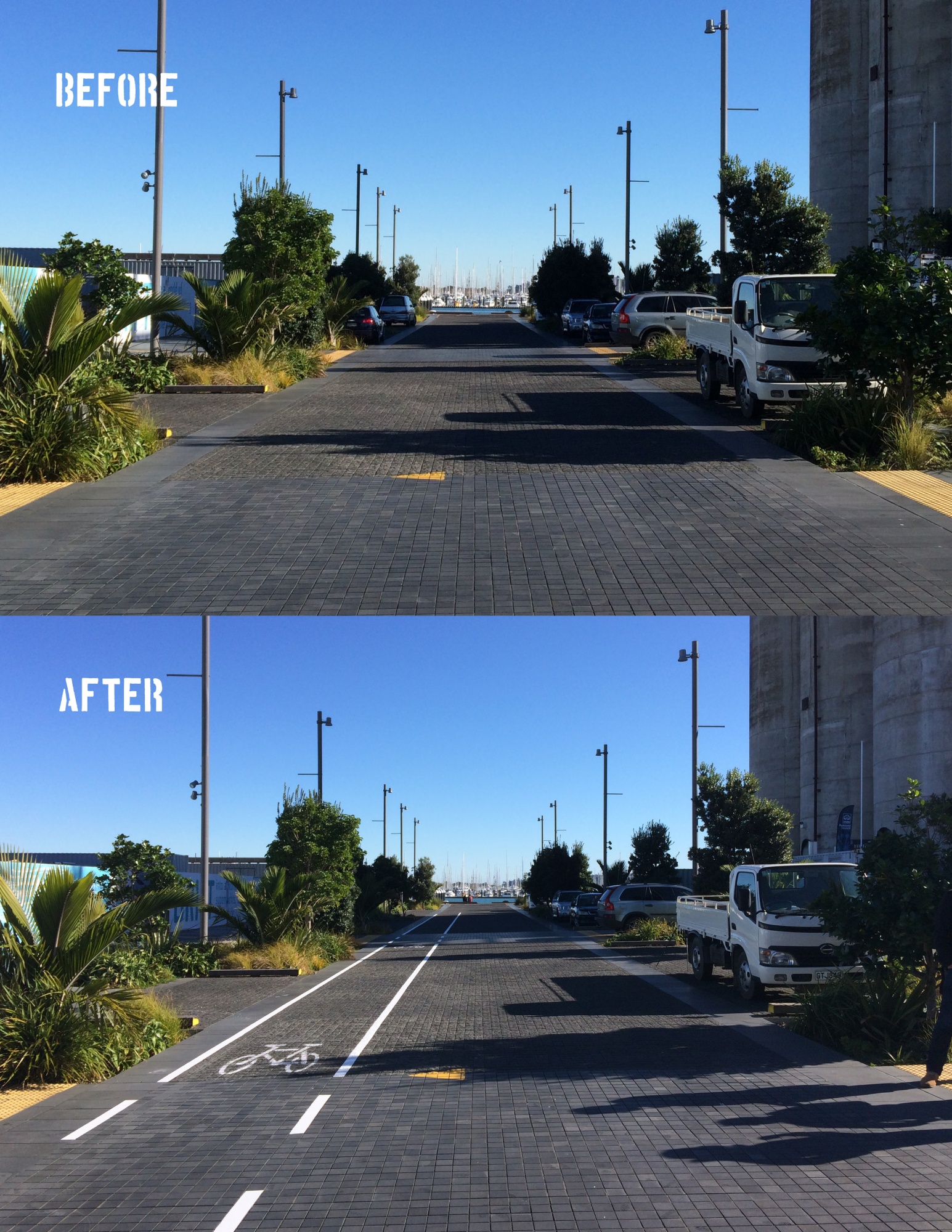
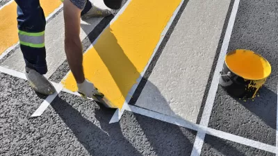
"The Tactical Urbanist's Guide to Materials and Design" will provide high-quality, engineer-approved guidance for implementing a range of interventions intended to make streets safe. In line with the Vision Zero goal of ending all traffic fatalities, the Guide focuses on rapidly implementing street-safety enhancement projects such as high-visibility crosswalks, curb extensions, pedestrian refuge islands, protected bike lanes, and public plazas.
To accompany the Guide, we're organizing a series of "beta city" workshops that will offer hands-on training for government departments looking to implement Tactical Urbanism projects (a Request for Interest is now available for North American cities).
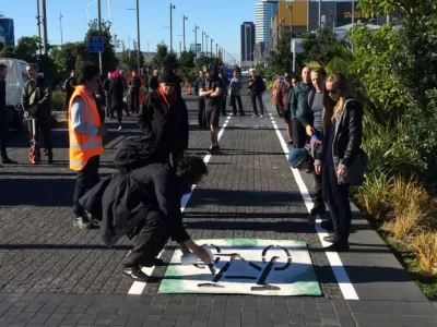
The Guide and workshop series was inspired by some work we conducted alongside Auckland Transport in June 2015. With a 150' roll of traffic tape lugged all the way from our Brooklyn office and bottle of spray chalk provided by a local advocate, we moved more than 40 AT engineers and planners out of the classroom and into the street to demonstrate how quick and simple change could be. At the completion of the workshop we realized a new guide outlining materials and a hands-on workshop approach could effectively help us transfer the knowledge—and materials—needed to implement demonstration, pilot and interim use projects.
Thanks to funding from the Knight Foundation and review support from NACTO and the Vision Zero Network, the Guide and workshops will provide information on how to create both short-term demonstration projects (typically led by community groups and lasting 1-7 days) as well as pilot and interim-design projects (often led by city governments and lasting from 30 days to several years). To inform the Guide, we're pulling together our own best practices from work in cities across the globe, as well as additional knowledge gleaned from a national research survey of the most effective materials and design used by leading cities today.
For both the Guide and workshops, our goal is simple: put more resources in the hands of cities ready to make quick changes, and involve more citizens along the way. In this way, we hope to inspire—and empower—a new generation of citizens, planners and policymakers to become key actors in the transformation of their communities.
Guerilla Urbanism: Small Interventions, Big Impact
Citizen-led projects can lead to broader changes — if cities will listen.
Tactical Urbanism Makes Strides in L.A.
A DIY urbanism group in Los Angeles has successfully prompted the city to install permanent crosswalks at dangerous intersections, despite the city’s insistence that the group’s do-it-yourself work is illegal.

How Tactical Urbanism Succeeds Where Bureaucracy Fails
Making the case for do-it-yourself infrastructure.

Pennsylvania Mall Conversion Bill Passes House
If passed, the bill would promote the adaptive reuse of defunct commercial buildings.

Planning for Accessibility: Proximity is More Important than Mobility
Accessibility-based planning minimizes the distance that people must travel to reach desired services and activities. Measured this way, increased density can provide more total benefits than increased speeds.

World's Largest Wildlife Overpass In the Works in Los Angeles County
Caltrans will soon close half of the 101 Freeway in order to continue construction of the Wallis Annenberg Wildlife Crossing near Agoura Hills in Los Angeles County.

Eviction Looms for Low-Income Tenants as Rent Debt Rises
Nonprofit housing operators across the country face almost $10 billion in rent debt.

Brightline West Breaks Ground
The high-speed rail line will link Las Vegas and the Los Angeles area.

Colorado Bans No-Fault Evictions
In most cases, landlords must provide a just cause for evicting tenants.
City of Costa Mesa
Licking County
Barrett Planning Group LLC
HUD's Office of Policy Development and Research
Mpact Transit + Community
HUD's Office of Policy Development and Research
Tufts University, Department of Urban and Environmental Policy & Planning
City of Universal City TX
ULI Northwest Arkansas
Write for Planetizen
Urban Design for Planners 1: Software Tools
This six-course series explores essential urban design concepts using open source software and equips planners with the tools they need to participate fully in the urban design process.
Planning for Universal Design
Learn the tools for implementing Universal Design in planning regulations.