


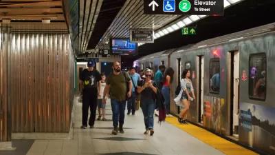
What's being described as an unprecedented outreach program will gather public feedback on a total of seven provincial and city-led transit projects for the Toronto area.
Tess Kalinoswki broke the news yesterday of a big announcement for transit in Toronto—a proposal that Toronto Chief Planner Jennifer Keesmaat called the 'motherlode' of transit planning.
"The result is a series of maps that show how the spine of Toronto transit — subways, GO tracks and streetcar rights-of-way — will steadily fill in with new rapid routes including trains, LRTs and busways," according to Kalinowski. The article includes a transit map of the proposed routes that will serve as suitable eye candy for fans of public transit.
Much of the day's news was devoted to the task of raising awareness about the outreach process that also launched yesterday. So far, the engagement process calls for 18 open houses.
The article also provides a list of the component projects included in the overall proposal. More details are included in the article:
- SmartTrack
- Relief Line
- Scarborough Subway Extension
- New GO/SmartTrack Stations
- Integrated Fares
- Regional Transportation Plan Review
FULL STORY: Planners want public’s input on ‘motherlode’ of GTA transit
How Real Are Toronto's Big Transit Plans?
Age-old transit planning questions will be raised over the next year in Toronto.

Toronto Transit Plans Take First Step Forward
The first phase of Toronto's 15-tear transit plan took a crucial step forward this week.
Toronto Subway Plan Gains Federal Backing
A key piece of the funding required to achieve Ontario Premier Doug Ford's vision for an expanded subway system in Greater Toronto Area clicked into place this week.

Pennsylvania Mall Conversion Bill Passes House
If passed, the bill would promote the adaptive reuse of defunct commercial buildings.

Planning for Accessibility: Proximity is More Important than Mobility
Accessibility-based planning minimizes the distance that people must travel to reach desired services and activities. Measured this way, increased density can provide more total benefits than increased speeds.

World's Largest Wildlife Overpass In the Works in Los Angeles County
Caltrans will soon close half of the 101 Freeway in order to continue construction of the Wallis Annenberg Wildlife Crossing near Agoura Hills in Los Angeles County.

Eviction Looms for Low-Income Tenants as Rent Debt Rises
Nonprofit housing operators across the country face almost $10 billion in rent debt.

Brightline West Breaks Ground
The high-speed rail line will link Las Vegas and the Los Angeles area.

Colorado Bans No-Fault Evictions
In most cases, landlords must provide a just cause for evicting tenants.
City of Costa Mesa
Licking County
Barrett Planning Group LLC
HUD's Office of Policy Development and Research
Mpact Transit + Community
HUD's Office of Policy Development and Research
Tufts University, Department of Urban and Environmental Policy & Planning
City of Universal City TX
ULI Northwest Arkansas
Urban Design for Planners 1: Software Tools
This six-course series explores essential urban design concepts using open source software and equips planners with the tools they need to participate fully in the urban design process.
Planning for Universal Design
Learn the tools for implementing Universal Design in planning regulations.