


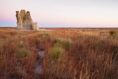
A map-making effort by The Washington Post's Wonkblog puts the Western United States' population, or lack thereof, in perspective.
"I don't know about you, but I'm a sucker for those maps that show the crazy geographic concentration of things like wealth and population," begins a recent post. He clearly wasn't talking to us at Planetizen because then he would know that we are a sucker for those maps that show crazy geographic concentration of things like wealth and population.
The map Ingraham shared with his audience on this occasion is meant to illustrate the "jaw-dropping emptiness of America." Sourced from Reddit, the original map shows "the enormous chunk of land where only 1 percent of the population lives." Ingraham updated the map for a bit more legibility and with the 2014 population numbers from the U.S. Census.
Ingraham provides a few different ways of putting the data shown on the map in perspective, in addition to offering one very specific mark of distinction:
The least-populated place in the United States is Alaska's Yukon-Koyukuk Census Area. At over 145,000 square miles, it's larger than New York, Pennsylvania, Maryland and Virginia -- combined. But it's home to only 5,547 people, for a population density of fewer than 4 people every 100 miles.
FULL STORY: Look at the jaw-dropping emptiness of America
Facebook AI Maps Population Density
Facebook expects to release its worldwide maps of human density in the coming months—potential applications will likely be somewhere on the spectrum between humanitarian and commercial.

Maps: How Much of Your City is Parking?
The percentage of land dedicated to parking in the central districts of major U.S. cities ranges from 4 percent to as much as 42 percent.

Mapping Climate Impact at the Neighborhood Level
A consumption-based analysis illustrates the differences in average household emissions across census tracts.

Pennsylvania Mall Conversion Bill Passes House
If passed, the bill would promote the adaptive reuse of defunct commercial buildings.

World's Largest Wildlife Overpass In the Works in Los Angeles County
Caltrans will soon close half of the 101 Freeway in order to continue construction of the Wallis Annenberg Wildlife Crossing near Agoura Hills in Los Angeles County.

U.S. Supreme Court: California's Impact Fees May Violate Takings Clause
A California property owner took El Dorado County to state court after paying a traffic impact fee he felt was exorbitant. He lost in trial court, appellate court, and the California Supreme Court denied review. Then the U.S. Supreme Court acted.

California Grid Runs on 100% Renewable Energy for Over 9 Hours
The state’s energy grid was entirely powered by clean energy for some portion of the day on 37 out of the last 45 days.

New Forecasting Tool Aims to Reduce Heat-Related Deaths
Two federal agencies launched a new, easy-to-use, color-coded heat warning system that combines meteorological and medical risk factors.

AI Traffic Management Comes to Dallas-Fort Worth
Several Texas cities are using an AI-powered platform called NoTraffic to help manage traffic signals to increase safety and improve traffic flow.
City of Costa Mesa
Licking County
Barrett Planning Group LLC
HUD's Office of Policy Development and Research
Mpact Transit + Community
HUD's Office of Policy Development and Research
Tufts University, Department of Urban and Environmental Policy & Planning
City of Universal City TX
ULI Northwest Arkansas
Urban Design for Planners 1: Software Tools
This six-course series explores essential urban design concepts using open source software and equips planners with the tools they need to participate fully in the urban design process.
Planning for Universal Design
Learn the tools for implementing Universal Design in planning regulations.