


The new Transit Explorer tool offers a new way to visualize the scale of the country's transit infrastructure investments. Spoiler alert: 2016 will be a big year.
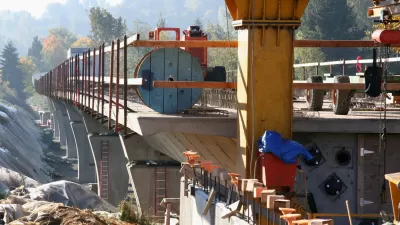
Yonah Freemark of The Transport Politic has released a new tool for visualizing the progress and promise of transit projects around the country. The value of Transit Explorer, as the new tool is called, is on display in a recent blog post by Freemark that performs an inventory of the transit openings and construction starts planned for 2016.
Freemark sums up the evidence visible on Transit Explorer:
"Cities across the country are waking up to new bus and rail lines in droves. In 2016, North American transit agencies are expected to open 245 miles of new fixed-guideway transit lines, including 89 miles of bus rapid transit, 93 miles of commuter rail, 7 miles of heavy rail, 39 miles of light rail, and 18 miles of streetcars. This is more than triple the new mileage of such lines opened in 2015."
Freemark has been doing inventories of expected transit projects since 2009, but this is the first time the effort is supplemented by Transit Explorer. The article also includes a lot of political context on the "long road to 2016" that enabled all of these projects. Freemark is offering a big, ambitious effort to make sense of the country's progress in transit.
FULL STORY: Openings and Construction Starts Planned for 2016

Transit Projects to Watch in 2015
The Transport Politic provides its seventh annual list of major transit investments, finding an enormous amount of effort and funds going into improving transportation systems around North America.
Ranking the Sustainability of Transportation Systems in North American Cities
Out of 23 cities, New York City came in first, Indianapolis came in 23rd.

Today: BART Goes Farther South Than Ever Before
As it has promised for years, Bay Area Rapid Transit today opens the Warm Springs/South Fremont extension of the regional rail transit system. The first train departs at the station at 5:48 am, and the first train arrives at 7:04 am.

Pennsylvania Mall Conversion Bill Passes House
If passed, the bill would promote the adaptive reuse of defunct commercial buildings.

Planning for Accessibility: Proximity is More Important than Mobility
Accessibility-based planning minimizes the distance that people must travel to reach desired services and activities. Measured this way, increased density can provide more total benefits than increased speeds.

World's Largest Wildlife Overpass In the Works in Los Angeles County
Caltrans will soon close half of the 101 Freeway in order to continue construction of the Wallis Annenberg Wildlife Crossing near Agoura Hills in Los Angeles County.

Colorado Bans No-Fault Evictions
In most cases, landlords must provide a just cause for evicting tenants.

Alaska Village Becomes Test Case for Climate Change Relocation
The Yup’ik village of Newtok is the first Alaska community to begin a full-scale relocation necessitated by the impacts of climate change. Another 31 Alaska communities remain vulnerable.

Amtrak Takes Lead on Texas Central Rail
The high-speed rail project isn’t a done deal, but if it moves forward, trains could begin operating in 2030.
City of Costa Mesa
Licking County
Barrett Planning Group LLC
HUD's Office of Policy Development and Research
Mpact Transit + Community
HUD's Office of Policy Development and Research
Tufts University, Department of Urban and Environmental Policy & Planning
City of Universal City TX
ULI Northwest Arkansas
Urban Design for Planners 1: Software Tools
This six-course series explores essential urban design concepts using open source software and equips planners with the tools they need to participate fully in the urban design process.
Planning for Universal Design
Learn the tools for implementing Universal Design in planning regulations.