


A new tool from the U.S. Department of Transportation and the Centers for Disease Control allows comparisons between state or metropolitan area on transportation and public health indicators.
"The U.S. Department of Transportation joined with the Centers for Disease Control and Prevention (CDC) to launch a new online tool that provides profiles of how transportation may be affecting human health in each state and region," according to an article in Metro magazine.
"The Transportation and Health Tool provides a single site for state and local transportation decision-makers and health officials to understand how their transportation system may affect health. For the first time, this site compiles data on how all states and communities are performing on a range of health-related transportation indicators."
My first pass through the tool revealed a work in progress: data for urbanized areas and metropolitan statistical areas were not available in the more reader-friendly format of the site's interactive map. Finer-grained data, however, is available in an Excel spreadsheet for download.
FULL STORY: New U.S. DOT tool promotes health through transportation

Europe Building a Post-Car Future
While the United States mobilizes to transition to electric cars, cities and countries in Europe are transitioning to fewer cars.
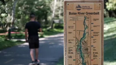
Boise Races Into the Lead on Separated Bike Lanes
The Ada County Highway District has announced a new program to separate bike lanes from vehicle lanes on arterial roadways in Boise and other cities around the county.

New Analysis Tools Measures Transportation Health Impacts
The Integrated Transport and Health Impact Model estimates how planning decisions affect public health, including physical activity, collisions and vehicle exhaust. This can help create healthier communities.

Pennsylvania Mall Conversion Bill Passes House
If passed, the bill would promote the adaptive reuse of defunct commercial buildings.

World's Largest Wildlife Overpass In the Works in Los Angeles County
Caltrans will soon close half of the 101 Freeway in order to continue construction of the Wallis Annenberg Wildlife Crossing near Agoura Hills in Los Angeles County.

U.S. Supreme Court: California's Impact Fees May Violate Takings Clause
A California property owner took El Dorado County to state court after paying a traffic impact fee he felt was exorbitant. He lost in trial court, appellate court, and the California Supreme Court denied review. Then the U.S. Supreme Court acted.

California Grid Runs on 100% Renewable Energy for Over 9 Hours
The state’s energy grid was entirely powered by clean energy for some portion of the day on 37 out of the last 45 days.

New Forecasting Tool Aims to Reduce Heat-Related Deaths
Two federal agencies launched a new, easy-to-use, color-coded heat warning system that combines meteorological and medical risk factors.

AI Traffic Management Comes to Dallas-Fort Worth
Several Texas cities are using an AI-powered platform called NoTraffic to help manage traffic signals to increase safety and improve traffic flow.
City of Costa Mesa
Licking County
Barrett Planning Group LLC
HUD's Office of Policy Development and Research
Mpact Transit + Community
HUD's Office of Policy Development and Research
Tufts University, Department of Urban and Environmental Policy & Planning
City of Universal City TX
ULI Northwest Arkansas
Urban Design for Planners 1: Software Tools
This six-course series explores essential urban design concepts using open source software and equips planners with the tools they need to participate fully in the urban design process.
Planning for Universal Design
Learn the tools for implementing Universal Design in planning regulations.