


An intrepid mapmaker and data cruncher has created a map that illustrates the ubiquity of fatalities on U.S. roads and highways.
Max Galka gathered the data from the U.S. Department of Transportation's Fatality Analysis Reporting System (FARS) into an interactive map that shows "373,377 points, one for each person who died in a vehicle crash between 2004 and 2013."
Each of the icons on the mapping representing data points also shows more information about the crash—i.e., whether the victim was a driver, passenger, or pedestrian, for instance. "Optionally, the map allows you to highlight crashes by contributing factor: alcohol, speeding, or distracted driving (using the Dept of Transportation’s definition)," adds Galka.
The map is an example of the democratic power of new mapping and data tools. Max Galka runs the Metrocosm website and created the map by himself, but people all over the country are picking up the story and sharing it online.
FULL STORY: Every Death on Every U.S. Road 2004-2013
Report: Racial Gap in Traffic Deaths Persists
Communities of color have significantly higher rates of traffic fatalities, according to federal research.

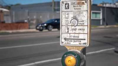
Acceptable Deaths
What can we learn from our Covid response?

New York City Traffic Fatalities Pass 2019 Totals
The visions of a car-free utopia that might have seemed like a potential silver lining in March and April have given away to a tragic reality.

Depopulation Patterns Get Weird
A recent ranking of “declining” cities heavily features some of the most expensive cities in the country — including New York City and a half-dozen in the San Francisco Bay Area.

California Exodus: Population Drops Below 39 Million
Never mind the 40 million that demographers predicted the Golden State would reach by 2018. The state's population dipped below 39 million to 38.965 million last July, according to Census data released in March, the lowest since 2015.

Pennsylvania Mall Conversion Bill Passes House
If passed, the bill would promote the adaptive reuse of defunct commercial buildings.

Google Maps Introduces New Transit, EV Features
It will now be easier to find electric car charging stations and transit options.

Ohio Lawmakers Propose Incentivizing Housing Production
A proposed bill would take a carrot approach to stimulating housing production through a grant program that would reward cities that implement pro-housing policies.

Chicago Awarded $2M Reconnecting Communities Grant
Community advocates say the city’s plan may not do enough to reverse the negative impacts of a major expressway.
City of Costa Mesa
Licking County
Barrett Planning Group LLC
HUD's Office of Policy Development and Research
Mpact Transit + Community
HUD's Office of Policy Development and Research
City of Universal City TX
ULI Northwest Arkansas
Town of Zionsville
Urban Design for Planners 1: Software Tools
This six-course series explores essential urban design concepts using open source software and equips planners with the tools they need to participate fully in the urban design process.
Planning for Universal Design
Learn the tools for implementing Universal Design in planning regulations.