


Aaron Renn scours the Internet to find 12 maps that attempt to do the impossible: define the geographic and cultural expanse known as the American Midwest.
A listicle by Aaron Renn surveys the many different approaches to mapping the Midwest.
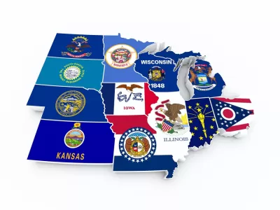
The list includes a traditional map, as defined in the early days of the United States, to the bureaucratic definition set forth but the U.S. Census Bureau. Other maps locate the Midwest in relation to the other "nations" in the United States and some break down the larger area of the Midwest into smaller sub-regions, such as the "Lower Lakes," the "North Woods," and the "Plains." Showing off the capabilities of the Internet, online survey mechanisms and the crowdsourcing power of Reddit have also helped a few intrepid social commentators create their own maps. Finally, other data collection methods have helped compile patterns out of the self-selecting behavior of Midwesterners.
FULL STORY: 12 Ways to Map the Midwest

Maps: How Much of Your City is Parking?
The percentage of land dedicated to parking in the central districts of major U.S. cities ranges from 4 percent to as much as 42 percent.

Mapping Climate Impact at the Neighborhood Level
A consumption-based analysis illustrates the differences in average household emissions across census tracts.

Top Websites for Urban Planning - 2022
Every year, Planetizen collects the websites breaking new digital ground in the world of planning and related fields.

Depopulation Patterns Get Weird
A recent ranking of “declining” cities heavily features some of the most expensive cities in the country — including New York City and a half-dozen in the San Francisco Bay Area.

California Exodus: Population Drops Below 39 Million
Never mind the 40 million that demographers predicted the Golden State would reach by 2018. The state's population dipped below 39 million to 38.965 million last July, according to Census data released in March, the lowest since 2015.

Chicago to Turn High-Rise Offices into Housing
Four commercial buildings in the Chicago Loop have been approved for redevelopment into housing in a bid to revitalize the city’s downtown post-pandemic.

Google Maps Introduces New Transit, EV Features
It will now be easier to find electric car charging stations and transit options.

Ohio Lawmakers Propose Incentivizing Housing Production
A proposed bill would take a carrot approach to stimulating housing production through a grant program that would reward cities that implement pro-housing policies.

Chicago Awarded $2M Reconnecting Communities Grant
Community advocates say the city’s plan may not do enough to reverse the negative impacts of a major expressway.
City of Costa Mesa
Licking County
Barrett Planning Group LLC
HUD's Office of Policy Development and Research
Mpact Transit + Community
HUD's Office of Policy Development and Research
City of Universal City TX
ULI Northwest Arkansas
Town of Zionsville
Urban Design for Planners 1: Software Tools
This six-course series explores essential urban design concepts using open source software and equips planners with the tools they need to participate fully in the urban design process.
Planning for Universal Design
Learn the tools for implementing Universal Design in planning regulations.