


A team of designers will convert one Mexico City's most dangerous highways into an urban oasis.
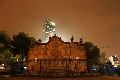
Centuries ago, Avenida Chapultepec was a canal dividing indigenous groups in the Aztec empire. Today, with only remnants of an abandoned aqueduct and Mexico City's oldest fountain, the wide avenue passes through the trendy neighborhoods of Roma and La Condesa, heading east from Chapultepec Park to the colonial and commercial center of the city.
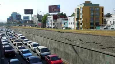
With one of the highest traffic accident rates for pedestrians, cyclists, and automobile drivers, the 10-lane highway is ripe for renovation. The city has hired a team of designers, led by Fernando Romero of FR-EE, to overhaul the busy street into a multi-level, green oasis for the city of 20 million. Romero's design for the thoroughfare draws inspiration from the history of water as a fundamental presence in the space. “We thought it would be nice to create a geometry based on the fluidity of water, creating a pedestrian connection among the city's various cultural contexts in the most efficient and seamless way,” says Romero.
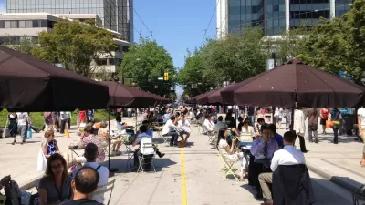
Heading west, the avenue will include a gradual inclination to a pedestrian-only elevated path with retail shops and an outdoor amphitheater. Along with troughs of water, and dedicated bike and bus lanes, the team plans to drastically increase the share of the avenue for pedestrians and double the number of trees. "The new avenue is designed to create a sense of discovery, pulling people through to enjoy the safe passage to the views, trees, and public spaces," writes Jared Green.
FULL STORY: Mexico City’s Ambitious Elevated Park
Gondola Monorail Could Ease Mexico City Traffic
Mexico City is considering a novel transit idea: two-person gondolas gliding along an aerial track. The costs of such a system may be far lower than extending the subway system.
How Did Vancouver Decrease its Traffic While Growing its Population?
With its elegant skyline, walkable streets and stunning parks, Vancouver exemplifies great city-making. Add to the list of achievements the city's ability to reduce traffic by 20 to 30 percent since 2006 while growing its population by 4.5 percent.
The Daily Commute and The Daily Protest in Mexico City
Frequent street closures due to unregulated protest -- up to about 7 per day -- clog the streets of Mexico City, leaving some hungry for a more active response from the government.

Pennsylvania Mall Conversion Bill Passes House
If passed, the bill would promote the adaptive reuse of defunct commercial buildings.

Coming Soon to Ohio: The Largest Agrivoltaic Farm in the US
The ambitious 6,000-acre project will combine an 800-watt solar farm with crop and livestock production.

World's Largest Wildlife Overpass In the Works in Los Angeles County
Caltrans will soon close half of the 101 Freeway in order to continue construction of the Wallis Annenberg Wildlife Crossing near Agoura Hills in Los Angeles County.

California Grid Runs on 100% Renewable Energy for Over 9 Hours
The state’s energy grid was entirely powered by clean energy for some portion of the day on 37 out of the last 45 days.

New Forecasting Tool Aims to Reduce Heat-Related Deaths
Two federal agencies launched a new, easy-to-use, color-coded heat warning system that combines meteorological and medical risk factors.

AI Traffic Management Comes to Dallas-Fort Worth
Several Texas cities are using an AI-powered platform called NoTraffic to help manage traffic signals to increase safety and improve traffic flow.
City of Costa Mesa
Licking County
Barrett Planning Group LLC
HUD's Office of Policy Development and Research
Mpact Transit + Community
HUD's Office of Policy Development and Research
Tufts University, Department of Urban and Environmental Policy & Planning
City of Universal City TX
ULI Northwest Arkansas
Urban Design for Planners 1: Software Tools
This six-course series explores essential urban design concepts using open source software and equips planners with the tools they need to participate fully in the urban design process.
Planning for Universal Design
Learn the tools for implementing Universal Design in planning regulations.