


Famously far-flung Atlanta is finding a comforting psychic barrier in the BeltLine, a 45-mile greenbelt in the place of former railroad tracks. The city and developers are trying to make the urban core more functional and attractive.

As in many other cities, young adults in Atlanta are increasingly choosing to live in the urban core rather than in any number of the region's sprawling suburbs. Even so, the contrast between central Atlanta and its outskirts has not, historically, been as stark as those in other cities. Many downtown destinations, like the Underground Atlanta mall, have remained relatively lifeless because of low residential densities and un-walkable streets.
The region, though, is in the process of building 45 miles worth of walkable, bikeable urban infrastructure. When completed, the BeltLine, plus a series of parks, will create a loop around central Atlanta with a 2-4 mile radius connecting 45 neighborhoods and creating a new sense of place for the central city. It has already "proven itself a powerful tool for changing the way people think about Atlanta’s development.
So far, $775 million worth of development has taken place within a half-mile of just one of the segments of the BeltLine. Planners tout developments like the adaptive reuse of a 1925 Sears warehouse and the 138-acre mixed-use Atlanta Station development.
"It isn’t hard to see a geographic correlation between the location of this trend and the outline of the Atlanta BeltLine. Looping the center of the city with a series of paths and parks, it will, when fully completed, pass through 45 close-in neighborhoods that are all within a two- to four-mile radius of downtown. Even in its partially completed early stages, the BeltLine has proven itself a powerful tool for changing the way people think about Atlanta’s development."
FULL STORY: Urbanising Atlanta
Surveying the Results of 150 Years of Persistent Growth in Atlanta
The American Institute of Architects will visit Atlanta this year, a month after the 150th anniversary of the end of the Civil War. What should we know about the city as it exists today?
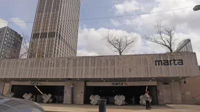
Atlanta Announces Four New MARTA Stations
The city’s Beltline will gain a new connection to heavy rail.
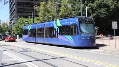
Atlanta’s Transit Past, Present, and Future
The city once had an extensive streetcar system. Can it revive public transit once again?

Pennsylvania Mall Conversion Bill Passes House
If passed, the bill would promote the adaptive reuse of defunct commercial buildings.

Planning for Accessibility: Proximity is More Important than Mobility
Accessibility-based planning minimizes the distance that people must travel to reach desired services and activities. Measured this way, increased density can provide more total benefits than increased speeds.

World's Largest Wildlife Overpass In the Works in Los Angeles County
Caltrans will soon close half of the 101 Freeway in order to continue construction of the Wallis Annenberg Wildlife Crossing near Agoura Hills in Los Angeles County.

Brightline West Breaks Ground
The high-speed rail line will link Las Vegas and the Los Angeles area.

Colorado Bans No-Fault Evictions
In most cases, landlords must provide a just cause for evicting tenants.

Alaska Village Becomes Test Case for Climate Change Relocation
The Yup’ik village of Newtok is the first Alaska community to begin a full-scale relocation necessitated by the impacts of climate change. Another 31 Alaska communities remain vulnerable.
City of Costa Mesa
Licking County
Barrett Planning Group LLC
HUD's Office of Policy Development and Research
Mpact Transit + Community
HUD's Office of Policy Development and Research
Tufts University, Department of Urban and Environmental Policy & Planning
City of Universal City TX
ULI Northwest Arkansas
Urban Design for Planners 1: Software Tools
This six-course series explores essential urban design concepts using open source software and equips planners with the tools they need to participate fully in the urban design process.
Planning for Universal Design
Learn the tools for implementing Universal Design in planning regulations.