


Friday fun in the form of a mapping challenge from the Washington Post's Wonkblog.
Emily Badger and Christopher Ingraham follow up on a post from earlier in the week that put bike infrastructure gaps in perspective by showing maps of bike routes removed from the filler of the auto-oriented street grid.
The original post included maps of the bike lane networks in Washington, D.C., Boston, Miami, and Seattle. A few intrepid bike and map enthusiasts even made more versions of cities around the world.
Then for a bit of fun, Badger and Ingraham transformed the map post into a pop quiz, of sorts, to challenge our mental maps. With the benefit of having read the post earlier this week and having most of this post written when I took the quiz, I scored 11 out of 11, earning myself a "Wow A+++!"
FULL STORY: Quiz: Can you identify these cities by only looking at their bike lanes?
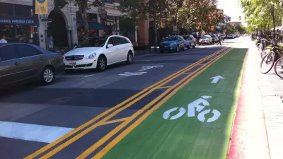
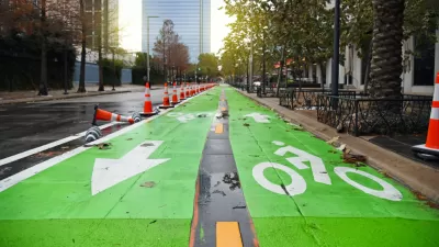
Pop Quiz: Name the City Based on its Cycle Lane Icon
The Guardian has a new pop quiz that will test the knowledge of urban aficionados that tend toward two-wheeled forms of transportation.
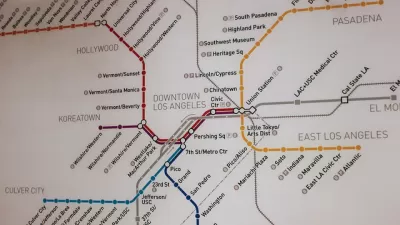
Pop Quiz: Can You Name Cities from their Transit Maps?
What better way to wind down from a long week thinking about cities and maps and transportation than by taking a quiz to show off your knowledge of cities and maps and transportation?
Houston Mayor Pauses Complete Streets Projects
The move raises concerns among road safety advocates who point out that traffic deaths continue to rise.

Pennsylvania Mall Conversion Bill Passes House
If passed, the bill would promote the adaptive reuse of defunct commercial buildings.

Coming Soon to Ohio: The Largest Agrivoltaic Farm in the US
The ambitious 6,000-acre project will combine an 800-watt solar farm with crop and livestock production.

World's Largest Wildlife Overpass In the Works in Los Angeles County
Caltrans will soon close half of the 101 Freeway in order to continue construction of the Wallis Annenberg Wildlife Crossing near Agoura Hills in Los Angeles County.

California Grid Runs on 100% Renewable Energy for Over 9 Hours
The state’s energy grid was entirely powered by clean energy for some portion of the day on 37 out of the last 45 days.

New Forecasting Tool Aims to Reduce Heat-Related Deaths
Two federal agencies launched a new, easy-to-use, color-coded heat warning system that combines meteorological and medical risk factors.

AI Traffic Management Comes to Dallas-Fort Worth
Several Texas cities are using an AI-powered platform called NoTraffic to help manage traffic signals to increase safety and improve traffic flow.
City of Costa Mesa
Licking County
Barrett Planning Group LLC
HUD's Office of Policy Development and Research
Mpact Transit + Community
HUD's Office of Policy Development and Research
Tufts University, Department of Urban and Environmental Policy & Planning
City of Universal City TX
ULI Northwest Arkansas
Urban Design for Planners 1: Software Tools
This six-course series explores essential urban design concepts using open source software and equips planners with the tools they need to participate fully in the urban design process.
Planning for Universal Design
Learn the tools for implementing Universal Design in planning regulations.