


Though the Los Angeles region is very dense, significant barriers to transit-oriented planning remain. Based on this analysis, the lack of a central urban core shouldn't be one of them.
Los Angeles urbanists often claim the nation's highest density, only to be reminded that their region still lacks an urban core. In a comparative density analysis of L.A. and San Francisco, Michael Rhodes throws that rebuttal into question.
Rhodes compared San Francisco's density statistics with what he dubbed "Central LA," a S.F.-sized superimposition on the City of Angels. "The surprising result? San Francisco and the 'city' of central LA (a subset of the larger municipality) are equal in population density over those 47 square miles, with about 837,000 people in both cities (all of SF and the core of LA). Not only that, but the LA core has about 85% as many jobs as San Francisco does, making it a substantial center of employment."
Predefined narratives about Los Angeles may impose themselves on policy decisions. "Another important reason is that LA doesn't treat Central LA as the true city it really is, where urban densities undoubtedly warrant putting pedestrians above space-hogging private automobiles."
From the article: "If there's one takeaway from this data, it's that LA has no reason not to go all-in in investing in its core, making it a more urban place, and seeing San Francisco not as an anomaly, but as a peer. As for us San Franciscans, maybe we can finally get over our fear of greater density. After all, do we want to be known as only as dense as LA?"
FULL STORY: Finding the Dense City Hidden in Los Angeles

Report Stresses Links Between Housing and Transit
A Canadian report calls for a more holistic approach to housing development policy and transportation planning.
‘Divided by Design’ Underscores Inequities in Transportation Policy
The report calls for a wholesale overhaul of U.S. transportation policy to redress the damages caused by decades of auto-centric development.

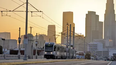
A Transit Ridership Role Reversal in California
Since the outset of the pandemic, the capital of car-oriented sprawl in California has become the king of public transit. Looking for lessons about the future of public transit in the United States? Look to San Francisco and Los Angeles.

Pennsylvania Mall Conversion Bill Passes House
If passed, the bill would promote the adaptive reuse of defunct commercial buildings.

Planning for Accessibility: Proximity is More Important than Mobility
Accessibility-based planning minimizes the distance that people must travel to reach desired services and activities. Measured this way, increased density can provide more total benefits than increased speeds.

World's Largest Wildlife Overpass In the Works in Los Angeles County
Caltrans will soon close half of the 101 Freeway in order to continue construction of the Wallis Annenberg Wildlife Crossing near Agoura Hills in Los Angeles County.

Amtrak Takes Lead on Texas Central Rail
The high-speed rail project isn’t a done deal, but if it moves forward, trains could begin operating in 2030.

Maine Approves Rent Relief Program
Legislators hope the assistance program will help struggling low-income households avoid eviction.

How Transit Architecture Impacts Real and Perceived Safety
More than a third of Americans believe major transit systems are too unsafe to ride. The built environment can change that.
City of Costa Mesa
Licking County
Barrett Planning Group LLC
HUD's Office of Policy Development and Research
Mpact Transit + Community
HUD's Office of Policy Development and Research
Tufts University, Department of Urban and Environmental Policy & Planning
City of Universal City TX
ULI Northwest Arkansas
Urban Design for Planners 1: Software Tools
This six-course series explores essential urban design concepts using open source software and equips planners with the tools they need to participate fully in the urban design process.
Planning for Universal Design
Learn the tools for implementing Universal Design in planning regulations.