


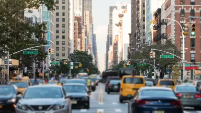
A post on Vox collects a series of maps from the "Atlas of the Historical Geography of the United States" showing how travel times changed over the past 200 years of U.S. history.
Phil Edwards offers some perspective on how far we've come in the past 200 years—or, put another way, how far we've come on how far we can go. For instance, "[back] in the early 1800s, without easily navigable roads or railroads, even a journey from New York to Washington, DC, was a multi-day affair."
Edwards shares a series of maps from the Atlas of the Historical Geography of the United States showing rates of travel at the moment of several technological and infrastructure breakthroughs, such as the construction of the National Road between 1811 and the 1830s and the Transcontinental Railroad in 1869.
One distinction to keep in mind, according to Edwards, is that the maps don't show a steady pace of progress, although change seems to have occurred quickly when looking back over the maps. "[The maps] also show how that progress advanced unevenly, in fits and starts. Railroads didn't reduce travel times right away — they still required significant infrastructure investments, ranging from laying down tracks to building tunnels. That took decades."
FULL STORY: Travel time is the forgotten breakthrough of the past 200 years
New Maps Compare Travel Times by Mode
Want to know the fastest way to get where you're going? You Are Here has created a new visualization tool that shows you the fastest mode for your trip in 11 cities.

Maps: How Much of Your City is Parking?
The percentage of land dedicated to parking in the central districts of major U.S. cities ranges from 4 percent to as much as 42 percent.
Mapping Climate Impact at the Neighborhood Level
A consumption-based analysis illustrates the differences in average household emissions across census tracts.

Pennsylvania Mall Conversion Bill Passes House
If passed, the bill would promote the adaptive reuse of defunct commercial buildings.

Planning for Accessibility: Proximity is More Important than Mobility
Accessibility-based planning minimizes the distance that people must travel to reach desired services and activities. Measured this way, increased density can provide more total benefits than increased speeds.

World's Largest Wildlife Overpass In the Works in Los Angeles County
Caltrans will soon close half of the 101 Freeway in order to continue construction of the Wallis Annenberg Wildlife Crossing near Agoura Hills in Los Angeles County.

How Transit Architecture Impacts Real and Perceived Safety
More than a third of Americans believe major transit systems are too unsafe to ride. The built environment can change that.

New York Passes Housing Package Focused on New Development and Adaptive Reuse
The FY 2025 budget includes a new tax incentive, funding for affordable housing on state land, and support for adaptive reuse and ADUs.

LA Metro Board Approves New 710 Freeway Plan
The newest plan for the 710 corridor claims it will not displace any residents.
City of Costa Mesa
Licking County
Barrett Planning Group LLC
HUD's Office of Policy Development and Research
Mpact Transit + Community
HUD's Office of Policy Development and Research
Tufts University, Department of Urban and Environmental Policy & Planning
City of Universal City TX
ULI Northwest Arkansas
Urban Design for Planners 1: Software Tools
This six-course series explores essential urban design concepts using open source software and equips planners with the tools they need to participate fully in the urban design process.
Planning for Universal Design
Learn the tools for implementing Universal Design in planning regulations.