


File under tools for the tool kit: Jarrett Walker of Human Transit shares details about Nearmap, an aerial photography tool that serves as a helpful alternative to Google Earth.
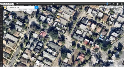
According to Jarrett Walker, "when it comes down to questions of rights-and-lefts, at the lowest level of planning altitude, one source of information is critical: aerial photography."
To aid planners of all stripes in the acquisition of useful aerial photography, Walker shares news of resource called Nearmap, which he describes as "an alternative to Google Earth that has grown more and more impressive. Initially confined to Australia and New Zealand (I used it all the time when I lived there) it now includes all large US cities. The site's best feature is the very recent, high-resolution imagery it offers, but it also has nice image capture and layer overlay tools, all in-browser."
FULL STORY: nearmap brings its high-resolution satellite imagery to the US
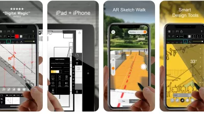
Best Apps for Urban Planning in 2022
Mobile apps continue to redefine the practices of planning—urban planning, regional planning, transportation planning, community planning, and rural planning included.
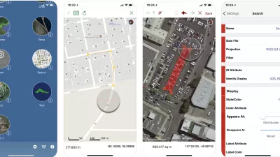
Top Planning Apps for 2019
Insights into the mobile app technology used in the practice and study of planning.
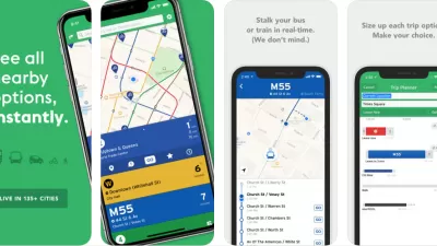
The Best Planning Apps
Planetizen is pleased to present the best of the latest crop of mobile apps by planners and for planners.

Pennsylvania Mall Conversion Bill Passes House
If passed, the bill would promote the adaptive reuse of defunct commercial buildings.

World's Largest Wildlife Overpass In the Works in Los Angeles County
Caltrans will soon close half of the 101 Freeway in order to continue construction of the Wallis Annenberg Wildlife Crossing near Agoura Hills in Los Angeles County.

U.S. Supreme Court: California's Impact Fees May Violate Takings Clause
A California property owner took El Dorado County to state court after paying a traffic impact fee he felt was exorbitant. He lost in trial court, appellate court, and the California Supreme Court denied review. Then the U.S. Supreme Court acted.

California Grid Runs on 100% Renewable Energy for Over 9 Hours
The state’s energy grid was entirely powered by clean energy for some portion of the day on 37 out of the last 45 days.

New Forecasting Tool Aims to Reduce Heat-Related Deaths
Two federal agencies launched a new, easy-to-use, color-coded heat warning system that combines meteorological and medical risk factors.

AI Traffic Management Comes to Dallas-Fort Worth
Several Texas cities are using an AI-powered platform called NoTraffic to help manage traffic signals to increase safety and improve traffic flow.
City of Costa Mesa
Licking County
Barrett Planning Group LLC
HUD's Office of Policy Development and Research
Mpact Transit + Community
HUD's Office of Policy Development and Research
Tufts University, Department of Urban and Environmental Policy & Planning
City of Universal City TX
ULI Northwest Arkansas
Urban Design for Planners 1: Software Tools
This six-course series explores essential urban design concepts using open source software and equips planners with the tools they need to participate fully in the urban design process.
Planning for Universal Design
Learn the tools for implementing Universal Design in planning regulations.