


Jordan Fraade writes of the embarrassing mishap of the New York City department that misread its own zoning maps. What else are we missing, and at what cost, because of byzantine land use regulations?
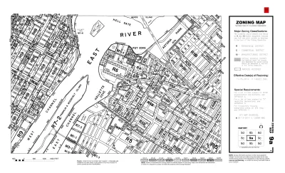
Fraade begins this tale of the high costs of broken zoning codes by citing the example of the New York City Department of Housing Preservation and Development, which realized in October that they had misread their own map.
"Late in October, planners took another look at the city’s zoning map and realized they made an error. Astoria Cove’s affordable apartments will actually have to target families making a maximum of 60 percent of AMI [rather than the 80 percent originally thought]."
Fraade notes the emotional and economic consequences of the reality of zoning in cities like New York City: "For New Yorkers who have spent decades trying to navigate the city’s housing market, it’s a small comfort to know that not even city planners can make sense of the city’s web of zoning policies. But this is nothing compared to the comfort that landlords feel, safe in the knowledge that they’ve used zoning to game the system."
Fraade goes on to draw some comparisons between the New York experience with examples from Los Angeles, Toronto, and Montreal, especially in light of the ongoing housing crisis in many cities around the world.
FULL STORY: Blame America’s housing woes on zoning laws

New York Launches New Housing Financing Initiative
The program is aimed at supporting housing projects with 70 percent or more affordable units.

Brooklyn Library Comes With Affordable Housing
Combining affordable housing with a library reduced the cost of the project and gives residents access to essential resources.

Zero New Housing Permits Issued in Manhattan Last Month
July was a dead month when it comes to approving new housing units.

Depopulation Patterns Get Weird
A recent ranking of “declining” cities heavily features some of the most expensive cities in the country — including New York City and a half-dozen in the San Francisco Bay Area.

California Exodus: Population Drops Below 39 Million
Never mind the 40 million that demographers predicted the Golden State would reach by 2018. The state's population dipped below 39 million to 38.965 million last July, according to Census data released in March, the lowest since 2015.

Chicago to Turn High-Rise Offices into Housing
Four commercial buildings in the Chicago Loop have been approved for redevelopment into housing in a bid to revitalize the city’s downtown post-pandemic.

New Park Opens in the Santa Clarita Valley
The City of Santa Clarita just celebrated the grand opening of its 38th park, the 10.5-acre Skyline Ranch Park.

U.S. Supreme Court: California's Impact Fees May Violate Takings Clause
A California property owner took El Dorado County to state court after paying a traffic impact fee he felt was exorbitant. He lost in trial court, appellate court, and the California Supreme Court denied review. Then the U.S. Supreme Court acted.

How Urban Form Impacts Housing Affordability
The way we design cities affects housing costs differently than you might think.
City of Costa Mesa
Licking County
Barrett Planning Group LLC
HUD's Office of Policy Development and Research
Mpact Transit + Community
HUD's Office of Policy Development and Research
City of Universal City TX
ULI Northwest Arkansas
Town of Zionsville
Urban Design for Planners 1: Software Tools
This six-course series explores essential urban design concepts using open source software and equips planners with the tools they need to participate fully in the urban design process.
Planning for Universal Design
Learn the tools for implementing Universal Design in planning regulations.