


Researchers at MIT have developed a new, flexible congestion pricing system.
As reported by Jordan Golson from Wired, the new system was developed for Singapore by graduate student Jason Gao and his advisor Li-Shiuan Peh from MIT, and is titled "RoadRunner." Unlike traditional systems forcing a toll on drivers, via cameras, sensors, or tollbooths, RoadRunner, "issues a digital 'token' to each car entering a congestion-prone area. Once a given number of tokens are assigned, a car can’t enter unless another vehicle leaves. Everyone else gets turn-by-turn directions to avoid the area. In computer simulations using data from Singapore’s Land Transit Authority, Gao and Peh saw an 8 percent increase in average car speed during periods of peak congestion. They also did a small scale test in Cambridge, Mass. to prove the technology works."
The advantage of this system allows for more dynamic and adaptable pricing based on special events within a specific geography. Urban planners can simply draw a polygon on the map and decide to manipulate the congestion zones in real time. Moreover, these changes can occur without any new construction of infrastructure. In addition, drivers are not penalized for entering these zones, but rather are aided in avoiding them altogether if possible.
Gao and Peh's research was honored at the Intelligent Transportation Systems World Congress last week, and will hopefully be implemented in field trials shortly.
FULL STORY: A System to Cut City Traffic That Just Might Work
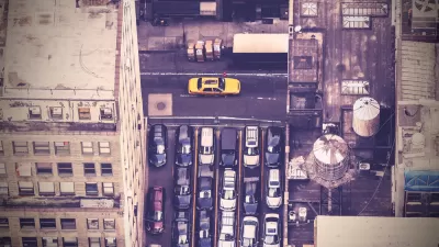
New York City Congestion Pricing Plan Deserves to Move Forward
Congestion pricing, done right (details matter), mitigates a downside of urban density: traffic congestion. Professor John Rennie Short explores the history of congestion pricing, its application in Singapore and London, and why it's good for NYC.
Congestion Pricing: The Key to Better Transit?
Noah Kazis describes the explosive success of transit systems in London, Stockholm, and Singapore, and suggests that charging motorists for road use is the secret ingredient that keeps ridership high and public support strong.
More Lanes Means More Traffic
U. of Toronto economist Matthew Turner discusses his study that shows that building more traffic lanes attracts more traffic. Likewise, providing more transit may lure motorists out of their cars, but those motorists are replaced.

Depopulation Patterns Get Weird
A recent ranking of “declining” cities heavily features some of the most expensive cities in the country — including New York City and a half-dozen in the San Francisco Bay Area.

California Exodus: Population Drops Below 39 Million
Never mind the 40 million that demographers predicted the Golden State would reach by 2018. The state's population dipped below 39 million to 38.965 million last July, according to Census data released in March, the lowest since 2015.

Chicago to Turn High-Rise Offices into Housing
Four commercial buildings in the Chicago Loop have been approved for redevelopment into housing in a bid to revitalize the city’s downtown post-pandemic.

New Park Opens in the Santa Clarita Valley
The City of Santa Clarita just celebrated the grand opening of its 38th park, the 10.5-acre Skyline Ranch Park.

U.S. Supreme Court: California's Impact Fees May Violate Takings Clause
A California property owner took El Dorado County to state court after paying a traffic impact fee he felt was exorbitant. He lost in trial court, appellate court, and the California Supreme Court denied review. Then the U.S. Supreme Court acted.

How Urban Form Impacts Housing Affordability
The way we design cities affects housing costs differently than you might think.
City of Costa Mesa
Licking County
Barrett Planning Group LLC
HUD's Office of Policy Development and Research
Mpact Transit + Community
HUD's Office of Policy Development and Research
City of Universal City TX
ULI Northwest Arkansas
Town of Zionsville
Urban Design for Planners 1: Software Tools
This six-course series explores essential urban design concepts using open source software and equips planners with the tools they need to participate fully in the urban design process.
Planning for Universal Design
Learn the tools for implementing Universal Design in planning regulations.