


Artist spends decades creating an always-growing hand-drawn paper map of an imaginary place. Development is determined by drawing a random card from a custom deck of cards.
Since 1963, Jerry Gretzinger has been drawing and painting an ever-growing paper map filled with imaginary cities, rivers, lakes, railroads, airports, highways, & farmlands. He uses a photocopier, pens, and paints and keeps track of the growing map's over 2600 "tiles" in a spreadsheet.
"Now Jerry uses a specially crafted deck of cards to determine the outcome of his world, with fictitious cities like “Plaeides,” “Wybourne” and the largest, “Ukrainia.” Each day he draws cards to see how a page of his gigantic map will be modified, with perhaps the most unusual card being the 'void.' With this card a blank spot is put on the map, wiping out previous details completely and opening up a world of new possibility. "
The map was on exhibit at the Massachusetts Museum of Contemporary Art in 2012. A zoomable version of the map is available online.
FULL STORY: VisualNews

Opinion: Enhancing Inclusive Development: The Crucial Role of the Creative Class in Urban Planning
How bringing local artists into the development process can foster more vibrant, equitable neighborhoods.

How the National Park Service Uses GIS
A new book demonstrates how the National Park Service uses GIS technology to meet its mission and showcases a selection of maps used for effectively managing national parks.
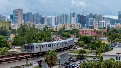
New Tool Puts Miami Development Opportunities on the Map
There's plenty of vacant or underutilized land to be found in Miami-Dade County, if you know where and how to look.

Pennsylvania Mall Conversion Bill Passes House
If passed, the bill would promote the adaptive reuse of defunct commercial buildings.

Coming Soon to Ohio: The Largest Agrivoltaic Farm in the US
The ambitious 6,000-acre project will combine an 800-watt solar farm with crop and livestock production.

World's Largest Wildlife Overpass In the Works in Los Angeles County
Caltrans will soon close half of the 101 Freeway in order to continue construction of the Wallis Annenberg Wildlife Crossing near Agoura Hills in Los Angeles County.

California Grid Runs on 100% Renewable Energy for Over 9 Hours
The state’s energy grid was entirely powered by clean energy for some portion of the day on 37 out of the last 45 days.

New Forecasting Tool Aims to Reduce Heat-Related Deaths
Two federal agencies launched a new, easy-to-use, color-coded heat warning system that combines meteorological and medical risk factors.

AI Traffic Management Comes to Dallas-Fort Worth
Several Texas cities are using an AI-powered platform called NoTraffic to help manage traffic signals to increase safety and improve traffic flow.
City of Costa Mesa
Licking County
Barrett Planning Group LLC
HUD's Office of Policy Development and Research
Mpact Transit + Community
HUD's Office of Policy Development and Research
Tufts University, Department of Urban and Environmental Policy & Planning
City of Universal City TX
ULI Northwest Arkansas
Urban Design for Planners 1: Software Tools
This six-course series explores essential urban design concepts using open source software and equips planners with the tools they need to participate fully in the urban design process.
Planning for Universal Design
Learn the tools for implementing Universal Design in planning regulations.