


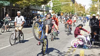
With bike use exploding across North America, The New York Times has asked its readers to submit their suggestions for how best to navigate their city streets on two wheels. Covering 16 cities, the project has received 4,614 comments to date.

On interactive maps for Los Angeles, Chicago, Austin, Boston, and 14 other cities, readers have pinpointed obstacles, short cuts, advisories and observations in ten words or less. Comments cover a range of local wisdom, from where recent accidents and assaults have taken place to the best routes to access bike paths and circumvent construction.
The New York maps also include a guide to "popular routes into Manhattan based on hundreds of thousands of rides taken by users of Strava, a running and cycling app."
FULL STORY: Your Biking Wisdom in 10 Words
Why Do People Hate Cyclists?
At the Association of Collegiate Schools of Planning conference, several researchers shared their work examining why people hate bicyclists and what can be done about that animosity.
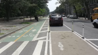
More Bicycle Infrastructure Equals More Riders
Analysis of Census data shows that, while still small in number, more Americans are taking to two-wheels as part of their daily commute.
Florida Pilots Bike Lanes on Highway Bridges
In an effort to create safer walking and biking environments, Miami-Dade counties have built bike lanes along two highways connecting the Miami with its eastern island beaches, reducing travel distances by 75 percent for cyclists.

Pennsylvania Mall Conversion Bill Passes House
If passed, the bill would promote the adaptive reuse of defunct commercial buildings.

World's Largest Wildlife Overpass In the Works in Los Angeles County
Caltrans will soon close half of the 101 Freeway in order to continue construction of the Wallis Annenberg Wildlife Crossing near Agoura Hills in Los Angeles County.

U.S. Supreme Court: California's Impact Fees May Violate Takings Clause
A California property owner took El Dorado County to state court after paying a traffic impact fee he felt was exorbitant. He lost in trial court, appellate court, and the California Supreme Court denied review. Then the U.S. Supreme Court acted.

New Forecasting Tool Aims to Reduce Heat-Related Deaths
Two federal agencies launched a new, easy-to-use, color-coded heat warning system that combines meteorological and medical risk factors.

AI Traffic Management Comes to Dallas-Fort Worth
Several Texas cities are using an AI-powered platform called NoTraffic to help manage traffic signals to increase safety and improve traffic flow.

Podcast: Addressing the Root Causes of Transit Violence
Deploying transit police is a short-term fix. How can transit agencies build sustainable safety efforts?
City of Costa Mesa
Licking County
Barrett Planning Group LLC
HUD's Office of Policy Development and Research
Mpact Transit + Community
HUD's Office of Policy Development and Research
Tufts University, Department of Urban and Environmental Policy & Planning
City of Universal City TX
ULI Northwest Arkansas
Urban Design for Planners 1: Software Tools
This six-course series explores essential urban design concepts using open source software and equips planners with the tools they need to participate fully in the urban design process.
Planning for Universal Design
Learn the tools for implementing Universal Design in planning regulations.