


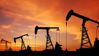
What's the most productive way to utilize the fertile land that sits above California's vast Monterey Shale oil reserve? The environmental impacts of fracking on California's farmland could derail what promises to be an enormous oil boom.
"Driven by advances in drilling technology and high oil prices, oil companies are increasingly moving into traditionally agricultural areas like Shafter that make up one of the world’s most fertile regions but also lie above a huge untapped oil reserve called the Monterey Shale," reports Norimitsu Onishi.
"By all accounts, oilmen and farmers — often shortened to 'oil and ag' here — have coexisted peacefully for decades in this conservative, business friendly part of California about 110 miles northwest of Los Angeles. But oil’s push into new areas and its increasing reliance on fracking, which uses vast amounts of water and chemicals that critics say could contaminate groundwater, are testing that relationship and complicating the continuing debate over how to regulate fracking in California."
“'We’re just seeing the tip of the iceberg of what’s coming,' said [Rex Parris, Mayor of Lancaster] of the drilling for Monterey Shale oil here. 'It could enrich the state beyond belief, but it could also destroy it.'”
FULL STORY: Fracking Tests Ties Between California ‘Oil and Ag’ Interests
West Texas Drilling Boom Bodes Ill for Residents, the Planet
Driven by foreign demand, a surge in West Texas oil production is having adverse effects on the local populace, and contributes to climate change at a crucial moment.

Voters to Decide on Repair of Vital Aqueduct for San Joaquin Valley
California voters in November will have the opportunity to help repair the Friant-Kern Canal, damaged by subsidence, as well as invest in watershed conservation programs, by passing a citizen-initiated $8.9 billion general obligation bond measure.
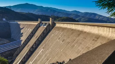
Why Are the Feds Suddenly in Favor of Raising the Shasta Dam?
Despite state opposition and potential violations of California law, the Trump Administration has revived a project that was deemed impracticable only a few years ago.

Pennsylvania Mall Conversion Bill Passes House
If passed, the bill would promote the adaptive reuse of defunct commercial buildings.

Coming Soon to Ohio: The Largest Agrivoltaic Farm in the US
The ambitious 6,000-acre project will combine an 800-watt solar farm with crop and livestock production.

World's Largest Wildlife Overpass In the Works in Los Angeles County
Caltrans will soon close half of the 101 Freeway in order to continue construction of the Wallis Annenberg Wildlife Crossing near Agoura Hills in Los Angeles County.

California Grid Runs on 100% Renewable Energy for Over 9 Hours
The state’s energy grid was entirely powered by clean energy for some portion of the day on 37 out of the last 45 days.

New Forecasting Tool Aims to Reduce Heat-Related Deaths
Two federal agencies launched a new, easy-to-use, color-coded heat warning system that combines meteorological and medical risk factors.

AI Traffic Management Comes to Dallas-Fort Worth
Several Texas cities are using an AI-powered platform called NoTraffic to help manage traffic signals to increase safety and improve traffic flow.
City of Costa Mesa
Licking County
Barrett Planning Group LLC
HUD's Office of Policy Development and Research
Mpact Transit + Community
HUD's Office of Policy Development and Research
Tufts University, Department of Urban and Environmental Policy & Planning
City of Universal City TX
ULI Northwest Arkansas
Urban Design for Planners 1: Software Tools
This six-course series explores essential urban design concepts using open source software and equips planners with the tools they need to participate fully in the urban design process.
Planning for Universal Design
Learn the tools for implementing Universal Design in planning regulations.