


Generalist Geoff Dyer delivers his walkability design tactics magnum opus on PlaceShakers. His years of practical experience are conveniently condensed for your consumption.
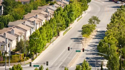
"As municipalities throughout North America seek to reform their development patterns (or at least expand their options) from the single-use zoning and automobile oriented regulations of the past century to those that allow for walkable, compact, mixed use places, there is a long list of standards and regulations that must be addressed. Often we discuss these issues in isolation, particularly the reform of use-based zoning into more responsive form-based zoning, and the reform of street standards from automobile-focused approaches to those that also balance the needs of bikes and pedestrians. Not only are these two regulations inextricably linked, but a roster of appropriate walkable street standards is absolutely essential to a form-based land use regulation. Where conventional zoning districts come with their own menu of street types (the ubiquitous local, collector, and arterial — all named for their vehicular function), so does the zoning for walkable urbanism (the street, avenue, and boulevard — to name a few)."
"Although the majority of our work on form-based regulations has been focused in the U.S., these ideas are increasingly catching on north of the border. While recently discussing this issue I was asked to convey what, in my experience, I have discovered as common considerations and issues when looking to create such standards in the Western Canadian context. Whether discussed in relation to a form-based code, or in isolation as 'walkable streets,' 'urban thoroughfares,' or (most popular), 'complete streets,' the truth is that many of the issues we face in Canada are the same as the ones we have faced in the U.S."
FULL STORY: Walkable Streets: Considering common issues
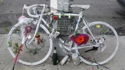
City Liable For Cyclist's Death Due to Poor Road Design
Road diets, whereby the number of traffic lanes are reduced to better accommodate cyclists, can be controversial. But what of the opposite—adding lanes to better accommodate motorists? A cyclist died after such an "improvement." A lawsuit followed.
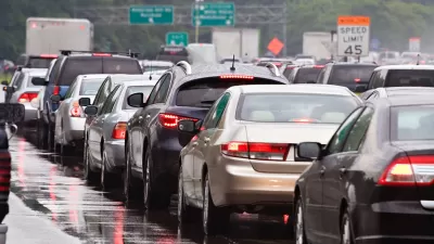
Another Study Shows That Narrow Is Safer Than Wide for Traffic Lanes
Better Cities & Towns gives its imprimatur to the "narrower is better" approach to lane width for traffic safety thanks to a study by Toronto transportation planner, Dewan Masud Karim, presented at the Canadian ITE annual conference.
End These 5 Transportation Planning 'Rule of Thumbs'
An op-ed calls for an end to five examples of them planning status quo, and recommends four new "rule of thumbs" that can provide a better model for the transportation planning of the future.

Pennsylvania Mall Conversion Bill Passes House
If passed, the bill would promote the adaptive reuse of defunct commercial buildings.

World's Largest Wildlife Overpass In the Works in Los Angeles County
Caltrans will soon close half of the 101 Freeway in order to continue construction of the Wallis Annenberg Wildlife Crossing near Agoura Hills in Los Angeles County.

U.S. Supreme Court: California's Impact Fees May Violate Takings Clause
A California property owner took El Dorado County to state court after paying a traffic impact fee he felt was exorbitant. He lost in trial court, appellate court, and the California Supreme Court denied review. Then the U.S. Supreme Court acted.

California Grid Runs on 100% Renewable Energy for Over 9 Hours
The state’s energy grid was entirely powered by clean energy for some portion of the day on 37 out of the last 45 days.

New Forecasting Tool Aims to Reduce Heat-Related Deaths
Two federal agencies launched a new, easy-to-use, color-coded heat warning system that combines meteorological and medical risk factors.

AI Traffic Management Comes to Dallas-Fort Worth
Several Texas cities are using an AI-powered platform called NoTraffic to help manage traffic signals to increase safety and improve traffic flow.
City of Costa Mesa
Licking County
Barrett Planning Group LLC
HUD's Office of Policy Development and Research
Mpact Transit + Community
HUD's Office of Policy Development and Research
Tufts University, Department of Urban and Environmental Policy & Planning
City of Universal City TX
ULI Northwest Arkansas
Urban Design for Planners 1: Software Tools
This six-course series explores essential urban design concepts using open source software and equips planners with the tools they need to participate fully in the urban design process.
Planning for Universal Design
Learn the tools for implementing Universal Design in planning regulations.