


An announcement last week indicates that Wikipedia will become the newest player in the increasingly competitive effort to connect virtual information with physical places.
No, it doesn't sound like Wikipedia will be taking on Google Maps anytime soon, but last week "software engineer Max Semenik announced that the organization has created a GeoData extension that will include a centralized, structured catalog of geo-coordinates for articles," reports Henry Grabar. "More than 500,000 Wikipedia articles — approximately 5 percent of the site's content — already contain geographical information, but this new initiative will streamline data storage, enabling programmers to mine and map the data quickly and easily through the API."
So what does this mean for us? By more thoroughly geotagging the most popular encyclopedia on the Internet, a treasure trove of information will become available to programmers and entrepreneurs.
"The first appearance of the new GeoData extension is in a mobile add-on called 'Nearby,' which shows users a list of nearby Wikipedia entries. (To activate 'Nearby,' select 'Settings' from the drop-down menu on the Wikipedia Mobile site, then activate 'Beta' mode, save, and then activate 'Here Be Dragons' mode. 'Nearby' will appear in the drop-down menu.)"
"This software is a pretty simple beginning," says Grabar, "but it's easy to see how interesting it could get."
FULL STORY: Wikipedia Nearby Is Basically a List of Interesting Things Near You

Is it Time to Revive the Pattern Language?
Software and other fields have made brilliant progress with the pattern language methodology, while built environment fields lag badly, mired in parochial debates over the massive book that invented the methodology.
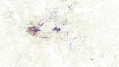
Friday Eye Candy: Maps Reveal Differences in How Locals and Tourists See the City
The cities that visitors see will always be different than the city that locals see. A new mapping project reveals the distinctions between the local perspective and the tourist perspective for 136 cities around the globe.

Mapping Interest in All Things Zombie
The three geographers behind the Floating Sheep blog have created a world map of Internet references to zombies.

Pennsylvania Mall Conversion Bill Passes House
If passed, the bill would promote the adaptive reuse of defunct commercial buildings.

Planning for Accessibility: Proximity is More Important than Mobility
Accessibility-based planning minimizes the distance that people must travel to reach desired services and activities. Measured this way, increased density can provide more total benefits than increased speeds.

World's Largest Wildlife Overpass In the Works in Los Angeles County
Caltrans will soon close half of the 101 Freeway in order to continue construction of the Wallis Annenberg Wildlife Crossing near Agoura Hills in Los Angeles County.

Eviction Looms for Low-Income Tenants as Rent Debt Rises
Nonprofit housing operators across the country face almost $10 billion in rent debt.

Brightline West Breaks Ground
The high-speed rail line will link Las Vegas and the Los Angeles area.

Colorado Bans No-Fault Evictions
In most cases, landlords must provide a just cause for evicting tenants.
City of Costa Mesa
Licking County
Barrett Planning Group LLC
HUD's Office of Policy Development and Research
Mpact Transit + Community
HUD's Office of Policy Development and Research
Tufts University, Department of Urban and Environmental Policy & Planning
City of Universal City TX
ULI Northwest Arkansas
Urban Design for Planners 1: Software Tools
This six-course series explores essential urban design concepts using open source software and equips planners with the tools they need to participate fully in the urban design process.
Planning for Universal Design
Learn the tools for implementing Universal Design in planning regulations.