


Unveiled at an event held last week at the University of Pittsburgh, "Oakland 2025: A vision for sustainable living and mobility" is the culmination of a process that involved a laundry list of institutional, community, and governmental partners.
Home to historic districts, universities, health care facilities, and cultural venues, Pittsburgh's Oakland neighborhood is truly ‘a city within a city'; which made developing a long-term comprehensive plan with the participation of a diverse set of partners all the more difficult.
"It's a monster," said Wanda Wilson, executive director of the Oakland
Planning and Development Corp. "I think the thing that's going to help
[with implementation] is that we have these partnerships in place -- not
that it's going to be a piece of cake."
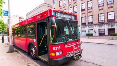
According to Diana Nelson Jones, "[p]riorities include an Oakland bus loop; better pedestrian navigation and
bicycle infrastructure; hillside restoration and other greening
efforts; more attractive gateways into Oakland; the return of the
Oakland Code Enforcement Task Force -- a resident-based network renamed
Oakwatch -- and better town-and-gown relations with outreach and
reclamation of student rentals in residential neighborhoods."
"Unlike most neighborhood-specific plans, Oakland's is likely to have
regional implications, especially as transportation goals are
implemented," says Jones.
"Obviously, as the third-largest employment center in the state, with
cultural institutions that serve the region, Oakland has to plan with
that in mind," said Jonathan Kline, co-principal at Studio for Spatial Practice. "At the same time, he said, there is a
certain parochial feel to each of Oakland's neighborhoods."
FULL STORY: Oakland shaping 'monster' of long-term vision plan

Pittsburgh Moves Ahead With Zoning Changes for University-Adjacent Neighborhood
The implementation of a new master plan for the neighborhood of Oakland, home to the University of Pittsburgh, is moving forward despite controversy and a contentious community engagement process.

$1.9 Billion in Development Investment Planned for Pittsburgh's Innovation District
Pittsburgh has one of the most lucrative innovation districts in the country, and even more development investment is on the way.
Pittsburgh to Oakland BRT Making Planning Progress
An ambitious plan to connect the Allegheny County cities of Pittsburgh and Oakland is proceeding to final stages of design, despite having fallen a little behind schedule for an expected 2021 opening date.

Pennsylvania Mall Conversion Bill Passes House
If passed, the bill would promote the adaptive reuse of defunct commercial buildings.

Planning for Accessibility: Proximity is More Important than Mobility
Accessibility-based planning minimizes the distance that people must travel to reach desired services and activities. Measured this way, increased density can provide more total benefits than increased speeds.

World's Largest Wildlife Overpass In the Works in Los Angeles County
Caltrans will soon close half of the 101 Freeway in order to continue construction of the Wallis Annenberg Wildlife Crossing near Agoura Hills in Los Angeles County.

Eviction Looms for Low-Income Tenants as Rent Debt Rises
Nonprofit housing operators across the country face almost $10 billion in rent debt.

Brightline West Breaks Ground
The high-speed rail line will link Las Vegas and the Los Angeles area.

Colorado Bans No-Fault Evictions
In most cases, landlords must provide a just cause for evicting tenants.
City of Costa Mesa
Licking County
Barrett Planning Group LLC
HUD's Office of Policy Development and Research
Mpact Transit + Community
HUD's Office of Policy Development and Research
Tufts University, Department of Urban and Environmental Policy & Planning
City of Universal City TX
ULI Northwest Arkansas
Urban Design for Planners 1: Software Tools
This six-course series explores essential urban design concepts using open source software and equips planners with the tools they need to participate fully in the urban design process.
Planning for Universal Design
Learn the tools for implementing Universal Design in planning regulations.