


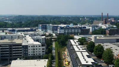
Despite recent controversy that claimed the BeltLine Inc’s president, when the 2.25-mile Eastside Trail opens this week, Atlanta's long-awaited Beltline will take its “most significant step forward yet,” reports Bill Torpy.
The vision for converting an abandoned railway corridor circling downtown Atlanta into a network of public parks, multi-use trails and transit - known as the BeltLine - began life as a doctoral thesis by Georgia Tech student Ryan Gravel in 1999. With Monday's opening of the Eastside Trail, Gravel's vision, which saw its transit plan take a hit with the rejection of a proposed transit sales tax in July, is facing another reality check.
"Ed McBrayer, executive director of PATH, the organization
charged with the corridor's construction oversight, calls this section 'a big first step. This will be a model case to see if the Beltline can
be all that we think it can be,' he said. 'This starts a network we've
been looking for, for 20 years. It will be a trail connecting Fernbank
to Centennial Park (downtown) to the MLK Center, to Piedmont Park to
Freedom Parkway. You can travel to a lot of destinations that mean
something.'"
Also, McBrayer added, "This section will either prove
or disprove that economic development will follow greenspace as we think
it might."
FULL STORY: Beltline a walk in the park
Atlanta Beltline Acquires Major Piece of the Future Eastside Trail
The Atlanta Beltline will be realized one step at a time, and this was a big one.
New Study Commissioned for Atlanta BeltLine Transit
The study will assess alignment options for a 13-mile segment of the greenway.
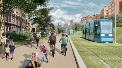
Atlanta Streetcar Expansion Still Moving Forward
MARTA has drastically reduced its plans to construct new rail transit, but one project still has political support from the top at City Hall.

Pennsylvania Mall Conversion Bill Passes House
If passed, the bill would promote the adaptive reuse of defunct commercial buildings.

Coming Soon to Ohio: The Largest Agrivoltaic Farm in the US
The ambitious 6,000-acre project will combine an 800-watt solar farm with crop and livestock production.

World's Largest Wildlife Overpass In the Works in Los Angeles County
Caltrans will soon close half of the 101 Freeway in order to continue construction of the Wallis Annenberg Wildlife Crossing near Agoura Hills in Los Angeles County.

California Grid Runs on 100% Renewable Energy for Over 9 Hours
The state’s energy grid was entirely powered by clean energy for some portion of the day on 37 out of the last 45 days.

New Forecasting Tool Aims to Reduce Heat-Related Deaths
Two federal agencies launched a new, easy-to-use, color-coded heat warning system that combines meteorological and medical risk factors.

AI Traffic Management Comes to Dallas-Fort Worth
Several Texas cities are using an AI-powered platform called NoTraffic to help manage traffic signals to increase safety and improve traffic flow.
City of Costa Mesa
Licking County
Barrett Planning Group LLC
HUD's Office of Policy Development and Research
Mpact Transit + Community
HUD's Office of Policy Development and Research
Tufts University, Department of Urban and Environmental Policy & Planning
City of Universal City TX
ULI Northwest Arkansas
Urban Design for Planners 1: Software Tools
This six-course series explores essential urban design concepts using open source software and equips planners with the tools they need to participate fully in the urban design process.
Planning for Universal Design
Learn the tools for implementing Universal Design in planning regulations.