


Susan Klemond looks at what it will take to protect and expand the Twin Cities's tremendous legacy of parks to meet the changing demographics and needs of the area's population.
A century ago, visionary planners and civic leaders in Minneapolis and St. Paul created a system of parks that are still treasured in the Twin Cities. Klemond looks at how Jayne Miller, Minneapolis Park and Recration Board superintendent, and other civic leaders in the area plan to maintain, evolve, and expand the Twin Cities's side-by-side park systems amid changing demographics, park needs, and ecological
considerations.
Two major elements of this planning effort are RiverFIRST and the Great River Passage, which envision how to develop parks and natural areas along 25
miles of the Mississippi River corridor in Minneapolis and St. Paul, respectively. "While
many cities around the world are now looking at their riverfronts, the
combined 25-mile Minneapolis/St. Paul corridor is the longest ever
undertaken as a unit, says Bruce Chamberlain, Minneapolis assistant
superintendent of planning."
Other efforts are looking at how to adapt park uses to suit the desires of changing demographics, re-envisioning the typical rec center, developing an ecological system plan, and facilitating urban agriculture.
FULL STORY: Creating public parks 3.0: new demographics, new needs

Twin Cities Trains Move to Fewer Cars, Higher Frequency
Headways will drop from 15 minutes to 12 minutes.

Twin Cities Parking Reform Shows Promising Results
Minneapolis and St. Paul both eliminated parking minimums, paving the way for less parking and more housing.
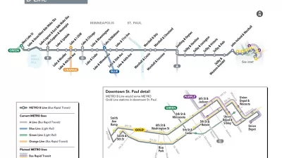
New Bus Rapid Transit Route Breaks Ground in the Twin Cities
The Twin Cities are on a mission to become the bus rapid transit capital of the United States. The latest improvement to advance that ambition broke ground earlier this week.

Depopulation Patterns Get Weird
A recent ranking of “declining” cities heavily features some of the most expensive cities in the country — including New York City and a half-dozen in the San Francisco Bay Area.

California Exodus: Population Drops Below 39 Million
Never mind the 40 million that demographers predicted the Golden State would reach by 2018. The state's population dipped below 39 million to 38.965 million last July, according to Census data released in March, the lowest since 2015.

Chicago to Turn High-Rise Offices into Housing
Four commercial buildings in the Chicago Loop have been approved for redevelopment into housing in a bid to revitalize the city’s downtown post-pandemic.

New Park Opens in the Santa Clarita Valley
The City of Santa Clarita just celebrated the grand opening of its 38th park, the 10.5-acre Skyline Ranch Park.

U.S. Supreme Court: California's Impact Fees May Violate Takings Clause
A California property owner took El Dorado County to state court after paying a traffic impact fee he felt was exorbitant. He lost in trial court, appellate court, and the California Supreme Court denied review. Then the U.S. Supreme Court acted.

How Urban Form Impacts Housing Affordability
The way we design cities affects housing costs differently than you might think.
City of Costa Mesa
Licking County
Barrett Planning Group LLC
HUD's Office of Policy Development and Research
Mpact Transit + Community
HUD's Office of Policy Development and Research
City of Universal City TX
ULI Northwest Arkansas
Town of Zionsville
Urban Design for Planners 1: Software Tools
This six-course series explores essential urban design concepts using open source software and equips planners with the tools they need to participate fully in the urban design process.
Planning for Universal Design
Learn the tools for implementing Universal Design in planning regulations.