


Yonah Freemark critiques a planned expansion to Dallas' already-extensive highway network, arguing that it undermines billions of dollars in light rail investment and sets its downtown on a path of stunted growth.
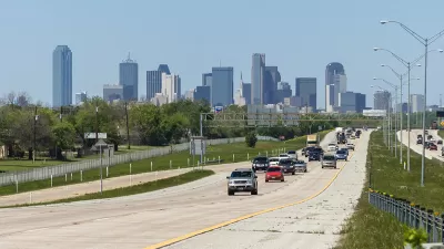
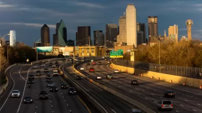
For the home of the nation's longest light rail network, Dallas struggles with astonishingly low transit ridership – just 4.2%, according to data from the U.S. Census Bureau. In Freemark's view, that might just have something to do with the city's aggressive highway expansion policy.
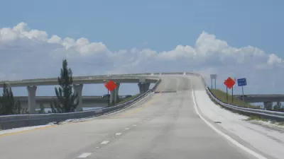
For in addition to its extensive light rail system, Downtown Dallas is penetrated by seven grade-separated highways, and may soon see the addition of another. At roughly $1.5 billion, the new toll road is intended to relieve road congestion by building parallel to both existing highways and the new Orange Line, which will open this summer.
"This is transportation planning at its worst," Freemark opines. "Public dollars are being spent on two separate transportation projects that offer similar benefits and serve the same corridors. The advantages of the investments made in rail - namely, the ability to avoid congestion - are being marginalized by the construction of a huge new road that will, at least for a few years (until the congestion returns), make choosing the train a poor choice... And the result is that all this investment will again produce low ridership."
Proponents of the expansion argue that the toll road is critical to future growth, a claim that Freemark contends is misguided.
"Highways, by encouraging car use, make the walking, transit-oriented city impossible. The growth that Dallas has seen in its central areas could be ephemeral with the wrong decisions made."
FULL STORY: A Tollway in Dallas and the Absurdity of Building Duplicative Infrastructure
Florida Highway Project Faces Opposition From All Sides
Critics worry the proposed 330-mile corridor would encourage sprawl, harm wildlife, and saddle the state with decades of debt.
Induced Demand: Why Highways Still Reign in Dallas
Regional planners and Dallas officials aren't confident that the area's highway-centric worldview (and budget) will change anytime soon. The city's competitiveness in the national job market may be on the line.
Highway Expansion Could Be Calamitous for Dallas' City Center
After a 2016 Texas Department of Transportation plan put forward a vision for a more walkable and dense city, TxDOT is still looking to expand I-30, a project that contradicts many of the forward-thinking ideas in that plan.

Pennsylvania Mall Conversion Bill Passes House
If passed, the bill would promote the adaptive reuse of defunct commercial buildings.

Depopulation Patterns Get Weird
A recent ranking of “declining” cities heavily features some of the most expensive cities in the country — including New York City and a half-dozen in the San Francisco Bay Area.

California Exodus: Population Drops Below 39 Million
Never mind the 40 million that demographers predicted the Golden State would reach by 2018. The state's population dipped below 39 million to 38.965 million last July, according to Census data released in March, the lowest since 2015.

Google Maps Introduces New Transit, EV Features
It will now be easier to find electric car charging stations and transit options.

Ohio Lawmakers Propose Incentivizing Housing Production
A proposed bill would take a carrot approach to stimulating housing production through a grant program that would reward cities that implement pro-housing policies.

Chicago Awarded $2M Reconnecting Communities Grant
Community advocates say the city’s plan may not do enough to reverse the negative impacts of a major expressway.
City of Costa Mesa
Licking County
Barrett Planning Group LLC
HUD's Office of Policy Development and Research
Mpact Transit + Community
HUD's Office of Policy Development and Research
City of Universal City TX
ULI Northwest Arkansas
Town of Zionsville
Urban Design for Planners 1: Software Tools
This six-course series explores essential urban design concepts using open source software and equips planners with the tools they need to participate fully in the urban design process.
Planning for Universal Design
Learn the tools for implementing Universal Design in planning regulations.