


An online map developed by the Lower Manhattan Construction Command Center documents change in New York City, and shows what development and construction is to come over the next eight years.
The group has taken a vast database of construction and planning data to provide a day-by-day look at development in Lower Manhattan -- all the way into 2018.
The group has "transferred their existing database-including building type, owner, developer, architect, start and end dates, and 3D building models-to Google Maps. Google Earth and the 4D time slider, which uses time stamps on SketchUp models to provide a snapshot of Lower Manhattan at any given date, were added in June."
FULL STORY: Building a Better Map
Saving Lower Manhattan
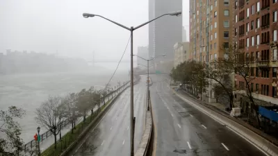
A debate over how to protect the East River waterfront from Sandy-level flooding and storm damage has delayed the project as community activists decry the city's last-minute change of plans.

How Should Lower Manhattan Handle Its Crowd Problem?
In the period since 9/11, Lower Manhattan has undergone a residential boom. With daytime professionals and tourists also in the mix, the strain is showing.
New York City Announces $100 Million Resilience Program for Lower Manhattan
New York City is launching a program that will spend $100 million in capital funding on storm protection infrastructure in lower Manhattan.

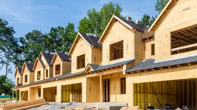
Pennsylvania Mall Conversion Bill Passes House
If passed, the bill would promote the adaptive reuse of defunct commercial buildings.

Planning for Accessibility: Proximity is More Important than Mobility
Accessibility-based planning minimizes the distance that people must travel to reach desired services and activities. Measured this way, increased density can provide more total benefits than increased speeds.
Fair Housing Cannot Take a Back Seat to ‘Build, Baby, Build’
If we overlook fair housing principles in the plan to build US housing back better, we risk ending up right back where we started.

LA Metro Board Approves New 710 Freeway Plan
The newest plan for the 710 corridor claims it will not displace any residents.

Austin’s Proposed EV Charging Rules Regulate Station Locations, Size
City planners say the new rules would ensure an efficient distribution of charging infrastructure across the city and prevent an overconcentration in residential areas.

Making California State Parks More Climate-Resilient
A recently released report offers recommendations for keeping state parks healthy and robust, including acquiring additional land for conservation and recreation.
City of Costa Mesa
Licking County
Barrett Planning Group LLC
HUD's Office of Policy Development and Research
Mpact Transit + Community
HUD's Office of Policy Development and Research
Tufts University, Department of Urban and Environmental Policy & Planning
City of Universal City TX
ULI Northwest Arkansas
Urban Design for Planners 1: Software Tools
This six-course series explores essential urban design concepts using open source software and equips planners with the tools they need to participate fully in the urban design process.
Planning for Universal Design
Learn the tools for implementing Universal Design in planning regulations.