


An interview with Eric Gordon, who was part of a team that recently won a MacArthur grant for using Second Life as a community planning tool.
In the interview, Eric describes how they used Second Life in community planning meetings:
"At each workshop we brought about fifteen community members together in a room, and they each had a laptop that we supplied. What they were looking at was a virtual reproduction of the park in Second Life. We built the context around the park-the library, and the houses around it-and left the park space open, as a big empty lot of grass. So first we would all walk through that tabula rasa of the site, and then we went through a brainstorming process, where people would throw out ideas [for what they wanted to see there], like a basketball court, a big sculpture, or seating, and we had a designer on hand who created those things on the fly."
FULL STORY: Q&A: Eric Gordon on Community Planning with Second Life

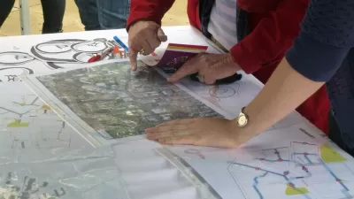
Using AI to Analyze Public Comments
A new tool is designed to help local governments organize and understand large volume of community input on projects.

Designing the Path to a Consequential Place
What is public interest design? And what should we be considering as we shape a process that fully embraces and realizes a project’s public interest potential? Understanding these key principles and characteristics can help.
Why Aren’t There More Planners?
Planning can be a great career for socially conscious individuals, but university programs are struggling to attract new students to the field. A trio of academics are raising awareness about the field through community activation.

Pennsylvania Mall Conversion Bill Passes House
If passed, the bill would promote the adaptive reuse of defunct commercial buildings.

Planning for Accessibility: Proximity is More Important than Mobility
Accessibility-based planning minimizes the distance that people must travel to reach desired services and activities. Measured this way, increased density can provide more total benefits than increased speeds.

World's Largest Wildlife Overpass In the Works in Los Angeles County
Caltrans will soon close half of the 101 Freeway in order to continue construction of the Wallis Annenberg Wildlife Crossing near Agoura Hills in Los Angeles County.

Eviction Looms for Low-Income Tenants as Rent Debt Rises
Nonprofit housing operators across the country face almost $10 billion in rent debt.

Brightline West Breaks Ground
The high-speed rail line will link Las Vegas and the Los Angeles area.

Colorado Bans No-Fault Evictions
In most cases, landlords must provide a just cause for evicting tenants.
City of Costa Mesa
Licking County
Barrett Planning Group LLC
HUD's Office of Policy Development and Research
Mpact Transit + Community
HUD's Office of Policy Development and Research
Tufts University, Department of Urban and Environmental Policy & Planning
City of Universal City TX
ULI Northwest Arkansas
Urban Design for Planners 1: Software Tools
This six-course series explores essential urban design concepts using open source software and equips planners with the tools they need to participate fully in the urban design process.
Planning for Universal Design
Learn the tools for implementing Universal Design in planning regulations.