


Once again, the New York City Department of Transportation (NYCDOT) delightfully surprises the design community with another major leap forward in making city streets a public realm for all users (I can’t tell you how odd it still feels to write that). As if the impressive, incessant roll-out of bike lanes, successful implementation of the “Select Bus Service”, and the unprecedented changes to Times Square and its environs weren’t enough to pique the imaginations of New Yorkers used to streets built for cars, NYCDOT has just issued their “2009 Street Design Manual”. Planners and Engineers, get ready for a thrill!

Once again, the New York City Department of Transportation (NYCDOT) delightfully surprises the design community with another major leap forward in making city streets a public realm for all users (I can't tell you how odd it still feels to write that). As if the impressive, incessant roll-out of bike lanes, successful implementation of the "Select Bus Service", and the unprecedented changes to Times Square and its environs weren't enough to pique the imaginations of New Yorkers used to streets built for cars, NYCDOT has just issued their "2009 Street Design Manual". Planners and Engineers, get ready for a thrill!
Don't let the year in the name fool you; if you've endured the rigors of learning the ropes of roadway design in New York City, then you know well enough that such a comprehensive document has never existed to guide the designer through the complexities of one of the most challenging processes known to man (Full disclosure: that might be a slight exaggeration). It is with great joy (and relief) that I can dispense with the ten-times-photocopied half-sheet details and loose collection of materials assembled over the years that substituted for a comprehensive design manual, and share with you a document that stresses the importance of accommodating all modes, offers a broad range of design treatments, and is bursting at the seams with visual examples and precedents from around the world (for illustrative purposes only, of course!).
So don't waste any more time reading my banter, dig into the 2009 Street Design Manual right away and discover the eerily new NYCDOT; it may in fact be the perfect set of guidelines for other cities to adopt in their pursuit of a safer, more balanced public street space. Enjoy!
http://www.nyc.gov/html/dot/html/about/streetdesignmanual.shtml
Nearly Half of New York City Burdened by Pollution
Communities of color make up the majority of people harmed by pollution, as well as heat and flooding, says the study, which is New York City’s first comprehensive survey of environmental injustices.
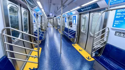
New York City Debuts Roomier Subway Cars
The car design is used throughout Europe and Asia, but it’s a first for the U.S.

To Build More Affordable Housing, Start With Narrower Streets
New research shows that reducing wasteful use of street space and eliminating overly wide streets would increase opportunities for housing development and higher density.

Pennsylvania Mall Conversion Bill Passes House
If passed, the bill would promote the adaptive reuse of defunct commercial buildings.

World's Largest Wildlife Overpass In the Works in Los Angeles County
Caltrans will soon close half of the 101 Freeway in order to continue construction of the Wallis Annenberg Wildlife Crossing near Agoura Hills in Los Angeles County.

U.S. Supreme Court: California's Impact Fees May Violate Takings Clause
A California property owner took El Dorado County to state court after paying a traffic impact fee he felt was exorbitant. He lost in trial court, appellate court, and the California Supreme Court denied review. Then the U.S. Supreme Court acted.

Indy Bikeshare System Turns 10, Expands to E-Bikes
Pacers Bikeshare riders logged over 700,000 rides since the system launched in 2014.

Coming Soon to Ohio: The Largest Agrivoltaic Farm in the US
The ambitious 6,000-acre project will combine an 800-watt solar farm with crop and livestock production.

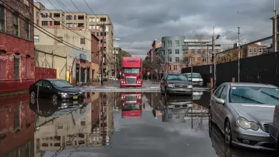
New York’s Deadliest Neighborhoods for Pedestrians
Pedestrian deaths rose last year, but remain below pre-2020 levels.
City of Costa Mesa
Licking County
Barrett Planning Group LLC
HUD's Office of Policy Development and Research
Mpact Transit + Community
HUD's Office of Policy Development and Research
Tufts University, Department of Urban and Environmental Policy & Planning
City of Universal City TX
ULI Northwest Arkansas
Write for Planetizen
Urban Design for Planners 1: Software Tools
This six-course series explores essential urban design concepts using open source software and equips planners with the tools they need to participate fully in the urban design process.
Planning for Universal Design
Learn the tools for implementing Universal Design in planning regulations.