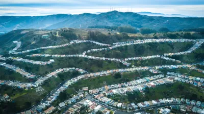
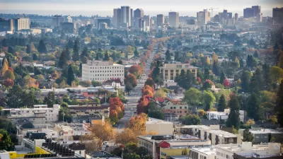
Visual communication is becoming more sophisticated in planning, however many online image sources are restricted and require payment for use. Others, such as flikr.com and Google Images are extremely useful but have uneven quality and information provided about the images can be difficult to assess. While flckr.com and Google Images will remain a key resource, a number of other online image databases provide more consistent metadata along with free access.
Visual communication is becoming more sophisticated in
planning, however many online image sources are restricted and require payment for use. Others,
such as flikr.com and Google Images are extremely useful but have uneven quality
and information provided about the images can be difficult to assess. While flckr.com and Google Images will remain a key resource, a
number of other online image databases provide more consistent metadata along with free access.
- Irin, the news service of the United Nations Office for the
Coordination of Humanitarian Affairs has wonderful, high quality images from
around the world. Users wanting high resolution images need to register, but
image use is free and I've had good luck getting permission to reprint photos
in publications. Go to: http://www.irinnews.org/photo.aspx
- The American Memory collection in the Library of
Congress has a rich collection of historical photos. Not all are digitized but
if you search for a key word, then slect "gallery view" as the display option
you'll see where images are available. Go to: http://memory.loc.gov/ammem/index.html
- The Lincoln Institute's new web site on Visual
Tools for Planners, under the direction of Lew Hopkins, has
handy examples of planning graphics. It seems to be still under development but could become a key resource. See: http://www.lincolninst.edu/subcenters/VTP/
- Strange Maps is a terrific blog featuring maps
of almost everything: http://strangemaps.wordpress.com/.
Scroll through each month or use the search feature to find maps organized by
theme or keyword. I first found this site through an earlier Planetizen blog
entry by Abhijeet Chavan at http://www.planetizen.com/node/29582
- Another great source for ideas about finding
images is the blog of Karen Brummand, the digital image instruction guru at Cornell. While some images she lists are restricted, her blog illustrates her great resourcefulness in locating images on the web. The digital image section and a special list on global cities are both useful.
- Several organizations have free images
collections including the Project for Public Spaces (http://www.pps.org/imagedb/?referrer=breadcrumb) and the Metropolitan
Design Center
image bank (http://www.designcenter.umn.edu/imagebank/index.html).
- Many public libraries and historical societies
have online collections. One of many good lists of such collections is: http://history.sandiego.edu/GEN/documents/clipsources.html
Some of my earlier posts have pointed to video and film resources
available online as well as planning scholarship available for free. In
upcoming months I'll be investigating various topics related to how planners
communicate, including more on visual communication.

Depopulation Patterns Get Weird
A recent ranking of “declining” cities heavily features some of the most expensive cities in the country — including New York City and a half-dozen in the San Francisco Bay Area.

California Exodus: Population Drops Below 39 Million
Never mind the 40 million that demographers predicted the Golden State would reach by 2018. The state's population dipped below 39 million to 38.965 million last July, according to Census data released in March, the lowest since 2015.

Chicago to Turn High-Rise Offices into Housing
Four commercial buildings in the Chicago Loop have been approved for redevelopment into housing in a bid to revitalize the city’s downtown post-pandemic.

How California Transit Agencies are Addressing Rider Harassment
Safety and harassment are commonly cited reasons passengers, particularly women and girls, avoid public transit.

Significant Investments Needed to Protect LA County Residents From Climate Hazards
A new study estimates that LA County must invest billions of dollars before 2040 to protect residents from extreme heat, increasing precipitation, worsening wildfires, rising sea levels, and climate-induced public health threats.

Federal Rule Raises Cost for Oil and Gas Extraction on Public Lands
An update to federal regulations raises minimum bonding to limit orphaned wells and ensure cleanup costs are covered — but it still may not be enough to mitigate the damages caused by oil and gas drilling.
City of Costa Mesa
Licking County
Barrett Planning Group LLC
HUD's Office of Policy Development and Research
Mpact Transit + Community
HUD's Office of Policy Development and Research
City of Universal City TX
ULI Northwest Arkansas
Town of Zionsville
Write for Planetizen
Urban Design for Planners 1: Software Tools
This six-course series explores essential urban design concepts using open source software and equips planners with the tools they need to participate fully in the urban design process.
Planning for Universal Design
Learn the tools for implementing Universal Design in planning regulations.


