In which metropolitan areas did businesses move to adopt the Internet most quickly? A July, 2003 research paper from Carnegie Mellon University, co-authored by Chris Forman, Avi Goldfarb and Shane Greenstein, explores the extent of commercial adoption of the Internet in the nation's 50 largest metropolitan areas. The paper -- "How did Location Affect Adoption of the Commercial Internet?-Global Village, Urban Density and Industry Composition" --explores the connection between industry composition and city size in explaining business use of the Internet.
In which metropolitan areas did businesses move to adopt the Internet most quickly?
A July, 2003 research paper from Carnegie Mellon University, co-authored by Chris Forman, Avi Goldfarb and Shane Greenstein, explores the extent of commercial adoption of the Internet in the nation's 50 largest metropolitan areas.
The paper --
"How did Location Affect Adoption of the Commercial Internet?-Global Village, Urban Density and Industry Composition" --explores the connection between industry composition and city size in explaining business use of the Internet.
Drawing on data from a private survey of businesses, they provide estimates of Internet adoption (basic Internet access for email and web-browsing) and enhancement (the deployment of e-business applications).
The abstract reads:
"The authors test opposing theories on how urban locations influenced the diffusion of Internet
technology. They find evidence that, controlling for industry, participation in the Internet is more likely in rural areas than in urban areas. Nevertheless, talk of the dissolution of cities is premature. Frontier Internet technologies appear more often at establishments in urban areas, even with industry controls.Major urban areas also contain many establishments from information technology-intensive industries, whose presence could reinforce the concentration of frontier Internet technologies in these areas. However, information technology-intensive industries are numerous and widespread. Hence, so is the use of frontier technology."
The paper is an interesting addition to the ongoing debate over whether "IT acts as a substitute or complement to the agglomeration of economic activity."
My vote goes for recognizing information technology as a complement and driver of the concentration of economic activity around a particular place.
(Thanks for EconData for the note.)

Pennsylvania Mall Conversion Bill Passes House
If passed, the bill would promote the adaptive reuse of defunct commercial buildings.

Coming Soon to Ohio: The Largest Agrivoltaic Farm in the US
The ambitious 6,000-acre project will combine an 800-watt solar farm with crop and livestock production.

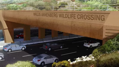
World's Largest Wildlife Overpass In the Works in Los Angeles County
Caltrans will soon close half of the 101 Freeway in order to continue construction of the Wallis Annenberg Wildlife Crossing near Agoura Hills in Los Angeles County.

California Grid Runs on 100% Renewable Energy for Over 9 Hours
The state’s energy grid was entirely powered by clean energy for some portion of the day on 37 out of the last 45 days.

New Forecasting Tool Aims to Reduce Heat-Related Deaths
Two federal agencies launched a new, easy-to-use, color-coded heat warning system that combines meteorological and medical risk factors.

AI Traffic Management Comes to Dallas-Fort Worth
Several Texas cities are using an AI-powered platform called NoTraffic to help manage traffic signals to increase safety and improve traffic flow.
City of Costa Mesa
Licking County
Barrett Planning Group LLC
HUD's Office of Policy Development and Research
Mpact Transit + Community
HUD's Office of Policy Development and Research
Tufts University, Department of Urban and Environmental Policy & Planning
City of Universal City TX
ULI Northwest Arkansas
Write for Planetizen
Urban Design for Planners 1: Software Tools
This six-course series explores essential urban design concepts using open source software and equips planners with the tools they need to participate fully in the urban design process.
Planning for Universal Design
Learn the tools for implementing Universal Design in planning regulations.


