With the $10 billion bond slated for the November ballot in California, the latest twist in the long saga of delays is that environmentalists, unhappy with the proposed route into the Bay Area from the Central Valley, threaten to litigate the EIR.
"The project's statewide environmental impact report was certified in 2005, giving the green light to proceed with engineering studies. The report encountered no opposition from any major state environmental group - a rarity for such a massive study - largely because the proposed routes are mainly planned along existing transit corridors and generally avoid environmentally sensitive areas. Virtually all of the system's thirty stations are slated for downtown areas, a proposal meant to reduce sprawl and encourage sustainable transit-oriented development in California's many languishing city centers.
But the Sierra Club and a number of other powerful environmental groups including Audubon California, the Nature Conservancy, and the National Resources Defense Council are less supportive about the authority's most recent environmental impact report, which focuses specifically on entry into the Bay Area and favors the Pacheco Pass alignment, which would make for a speedier route from San Francisco to Los Angeles and also would be cheaper to build. That route would go from Los Banos in Merced County to Gilroy before heading north to San Jose and up the Peninsula to San Francisco along the CalTrain right-of-way.
"We think this report is fatally flawed," said Bill Allayaud, the Sierra Club's state legislative director. "There's a bias toward the Pacheco Pass in the way they account for ridership and ... environmental impacts."
Allayaud alleges that politics, rather than sound science, influenced the decision; Silicon Valley, which would be directly serviced, lobbied hard for the southern route while communities in the Tri-Valley fended off the Altamont Pass, not wanting the railroad in their backyards.
He believes it makes far more sense for the train to go through the Altamont Pass' already urban corridor. Although little-known, he said, the other route goes through some "of the most pristine and important wetlands left in California." Specifically, it bisects the Grasslands Ecological Area, which, at more than 90,000 acres, is the largest contiguous block of wetlands in California and a wintering area for more than 1 million birds in the Pacific Flyway. Located about fifteen miles north of Los Banos, the area boasts uncommon types of freshwater wetlands and native grasslands, supporting more than 500 species of plants and animals, some of which are endangered or threatened.
While the Altamont route also would interact with protected wetlands - the South Bay's Don Edwards National Wildlife Refuge - the coalition believes the environmental impact would be far less harmful.
In the strong likelihood that the rail authority's board votes to certify the environmental impact report in March, Allayaud's coalition has thirty days to file a lawsuit, something it is seriously considering. "Pick the wrong route and we're going to have a train wreck," he said."
Thanks to Rob Wrenn

Pennsylvania Mall Conversion Bill Passes House
If passed, the bill would promote the adaptive reuse of defunct commercial buildings.

Planning for Accessibility: Proximity is More Important than Mobility
Accessibility-based planning minimizes the distance that people must travel to reach desired services and activities. Measured this way, increased density can provide more total benefits than increased speeds.

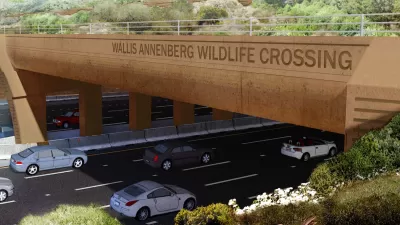
World's Largest Wildlife Overpass In the Works in Los Angeles County
Caltrans will soon close half of the 101 Freeway in order to continue construction of the Wallis Annenberg Wildlife Crossing near Agoura Hills in Los Angeles County.

Eviction Looms for Low-Income Tenants as Rent Debt Rises
Nonprofit housing operators across the country face almost $10 billion in rent debt.

Brightline West Breaks Ground
The high-speed rail line will link Las Vegas and the Los Angeles area.

Colorado Bans No-Fault Evictions
In most cases, landlords must provide a just cause for evicting tenants.
City of Costa Mesa
Licking County
Barrett Planning Group LLC
HUD's Office of Policy Development and Research
Mpact Transit + Community
HUD's Office of Policy Development and Research
Tufts University, Department of Urban and Environmental Policy & Planning
City of Universal City TX
ULI Northwest Arkansas
Urban Design for Planners 1: Software Tools
This six-course series explores essential urban design concepts using open source software and equips planners with the tools they need to participate fully in the urban design process.
Planning for Universal Design
Learn the tools for implementing Universal Design in planning regulations.


